
A LOCAL LOOK
A spring storm takes aim at the Interior West, a brief discussion of dust-on-snow, and a look at recent snowpack conditions in central Idaho.

Note: This will mostly be a look at snow and conditions here in central Idaho, with a bit of information about conditions in the Western US.
It is April 17th, and many avalanche centers have stopped issuing daily avalanche forecasts for the season. At this time of year, information about the snow becomes harder to come by and quality observations are few and far between. Here is a look at the national danger map from Avalanche.org for April 17th:
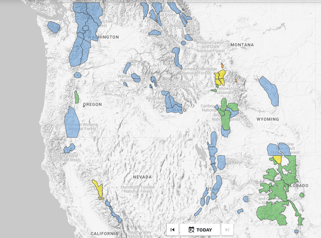
Colder temperatures have helped to decrease the likelihood of wet snow issues today. However, an energetic spring storm is bringing a good shot of new snow to the interior Rockies from Montana to Colorado. This new snow is increasing the chances of dry slab issues in these locations and will be an easy target for the sun when it returns this weekend and next week. In SW Montana enough snow has already stacked up to increase the avalanche danger, and danger is expected to rise in Wyoming and Colorado overnight and into tomorrow.
A LOCAL LOOK
Here in central Idaho, we have lucked out with good stability and good coverage for much of the ski season. A few major weak layers (12/13, 1/31, and 3/12) developed and were buried throughout the year, but these layers have done their thing and have generally become unreactive. Re-activating these layers will be most likely on shady middle and upper elevation slopes during extended periods of melt without freezes as water saturates a dry snowpack.
Thanks to this, our main focus is on the recent weather and near the surface of the snowpack. Wet snow issues have been the main concern during the month of April, and most wet avalanches have been relatively small. There was a minor rash of human-triggered wind slab activity on April 8th following a cold storm, but these slabs bonded quickly to the snow they fell on. Here is a look at snow height and temperatures from a few local weather stations over the past week:
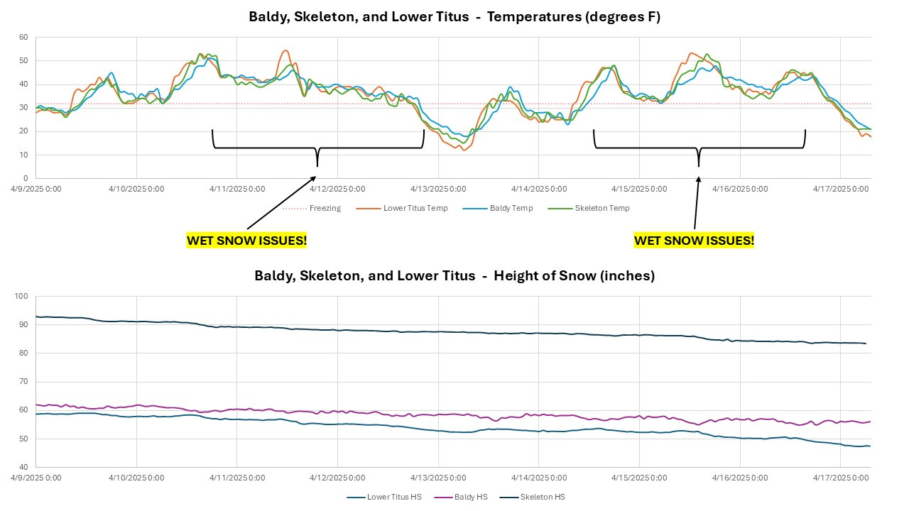
And here is a quick narrative trip through the past week:
Thursday, 4/10: This was the first day of gradually worsening wet snow problems following a cold storm on 4/8. It was warm and sunny with light winds. The snowpack had a solid refreeze overnight leading into Thursday which helped prevent more widespread wet issues from developing. Shaded slopes stayed cold and dry this day:

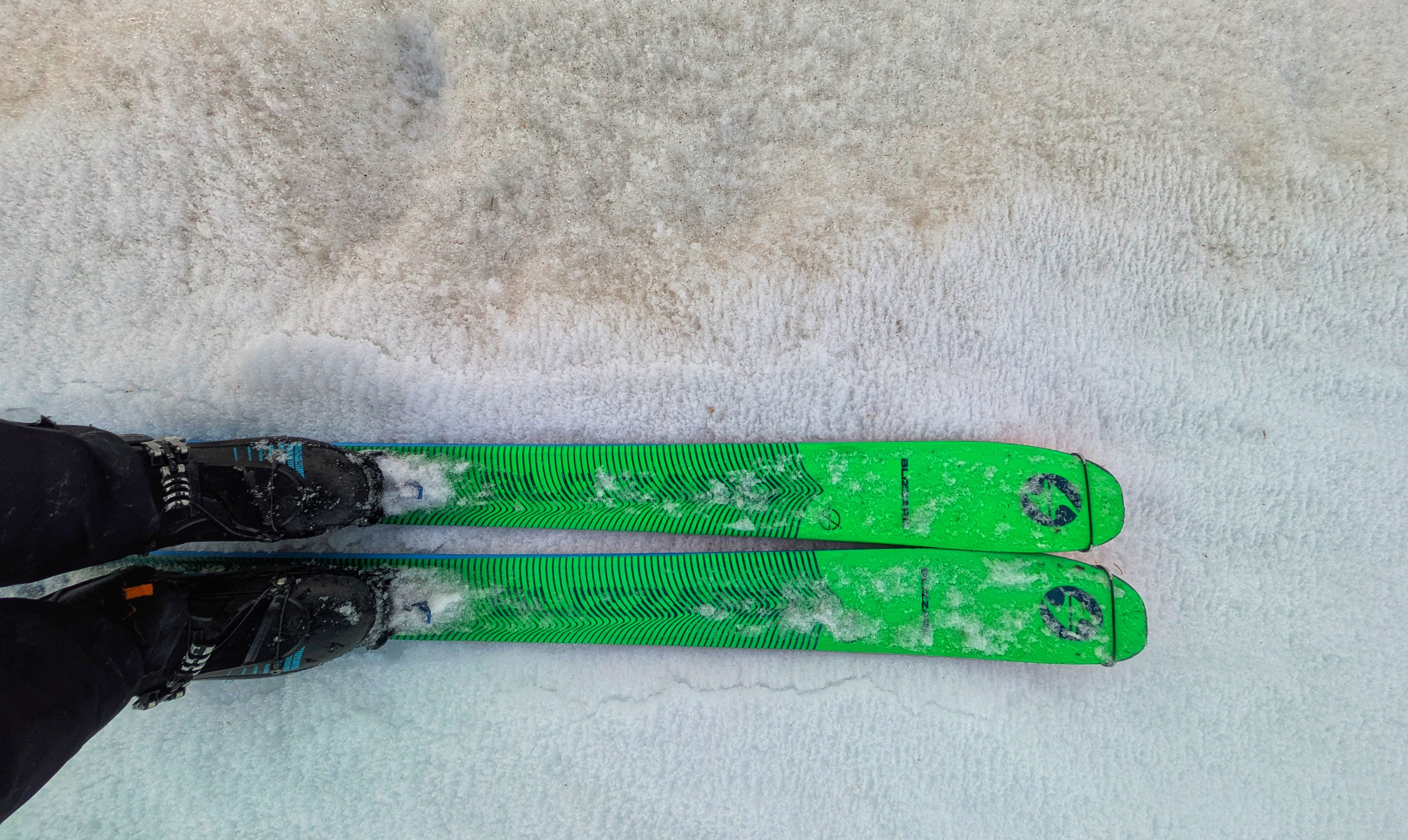
April 10, 2025 - Cold powder skiing on N aspect at 10,000’. Friday, 4/11: There was a weak to absent refreeze overnight with mountain temperatures hovering around 40 F. Cloud cover built overnight into Friday, which didn’t help the freeze but did limit the amount of direct solar radiation that the snowpack experienced. Temperatures were warm enough to affect upper elevation shady slopes, which did a ton of settling and a bit of melting this day. We lost a lot of good, cold skiing, unfortunately:

April 11, 2025 - Snow surfaces melting from warm temperatures. Photo shows turns in moist schmoo on a N aspect at 9,500’. Saturday, 4/12: Another weak to absent refreeze leading into Saturday, with lots of clouds to trap the heat. This resulted in a rapid breakdown of any surface crusts at lower and middle elevations with plenty of “isothermal mank” to be found. Skies cleared in the morning and temperatures gradually cooled through the day.
Sunday, 4/13: Overnight temperatures dropped into the teens F and skies remained clear, allowing for a great refreeze. Daytime highs struggled to get much above freezing this day. The corn developed slowly and lasted all day long. There was excellent corn skiing on many aspects.
Monday, 4/14: Another very hard refreeze overnight, but daytime temperatures were about 10 degrees F warmer than the previous day. Good corn skiing came online earlier in the day and over-ripened in places by the afternoon. Corn skiing was excellent again today, but the windows were somewhat narrower than on 4/13.
Tuesday, 4/15: Much weaker refreeze overnight, with mountain temps struggling to drop down to freezing (32 F). Daytime highs were another 5-10 degrees F warmer than 4/14 and the window for good corn came much earlier in the day. Small natural wet loose avalanches were releasing by early afternoon, which was the first reported wet snow activity since 4/11.
Wednesday, 4/16: Another weak to absent refreeze overnight, with daytime high temperatures 5-10 degrees F cooler than 4/15. The snowpack has started to accumulate significant amounts of meltwater below surficial crusts since 4/14. It will take a few days with colder temperatures to completely drain and refreeze this water.
Thursday, 4/17: Temperatures plummeted overnight as a low pressure center and associated cold front sagged in from the N. Light snow arrived in the morning hours with snow falling all the way down to valley bottoms on either side of Galena Summit.
A DUSTY DIVERSION
There have been several major rounds of dust-on-snow deposition here in Idaho this season. A pair of events at the beginning of February and another event on March 16th. A series of storms temporarily buried this dust, but as the upper snowpack has melted, the dust has reappeared. Here is a look at the likely source of the 3/16 dust for us in Idaho; the magenta plumes in NW Nevada are blowing dust:
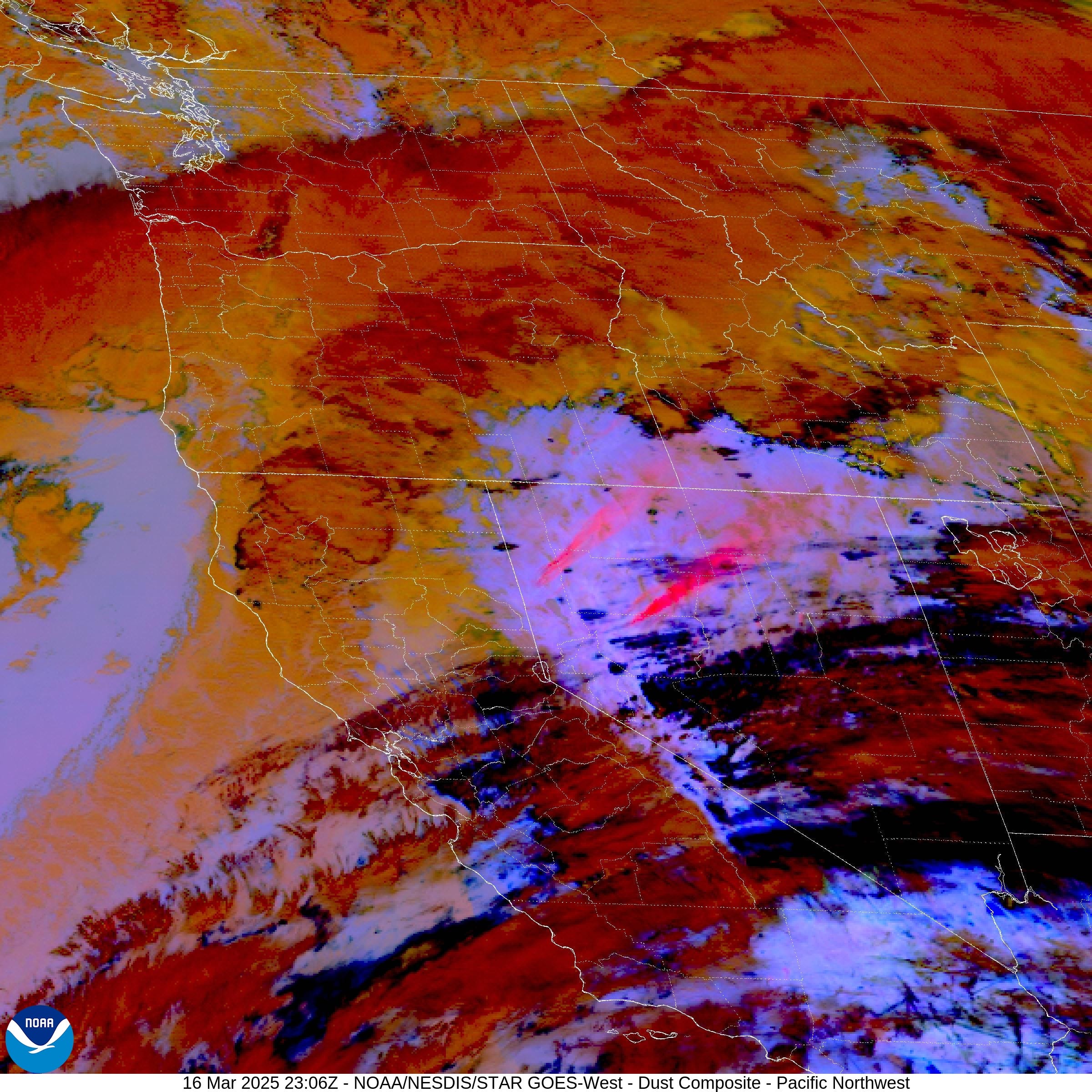
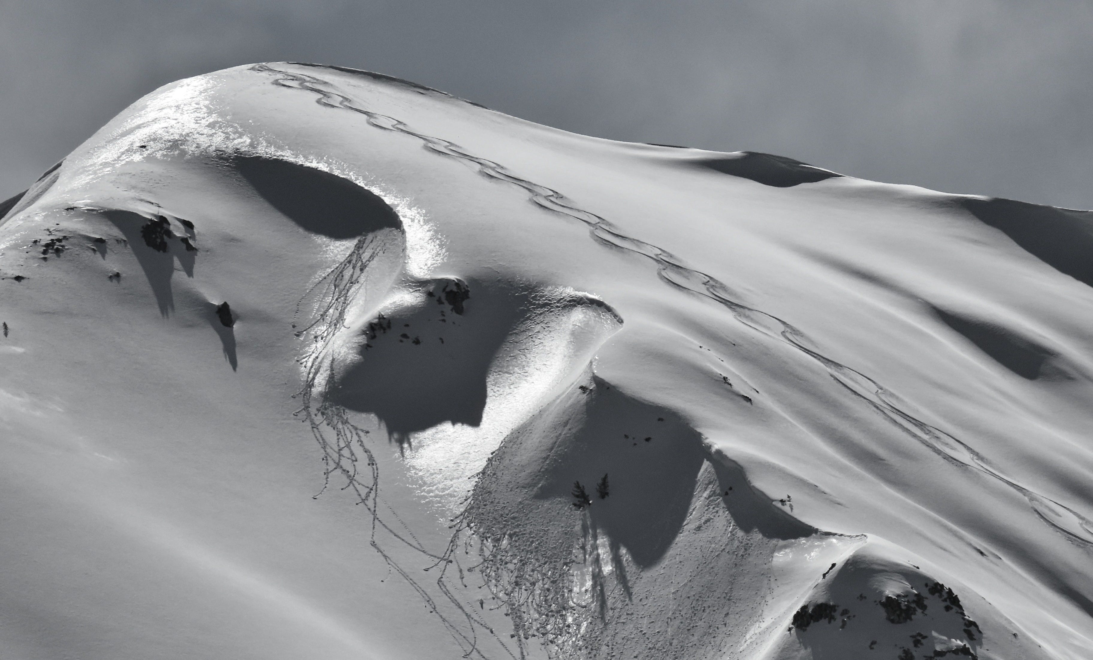
And here is a look at the mid-March dust reappearing on a SE-facing slope at 8,600’ this week:
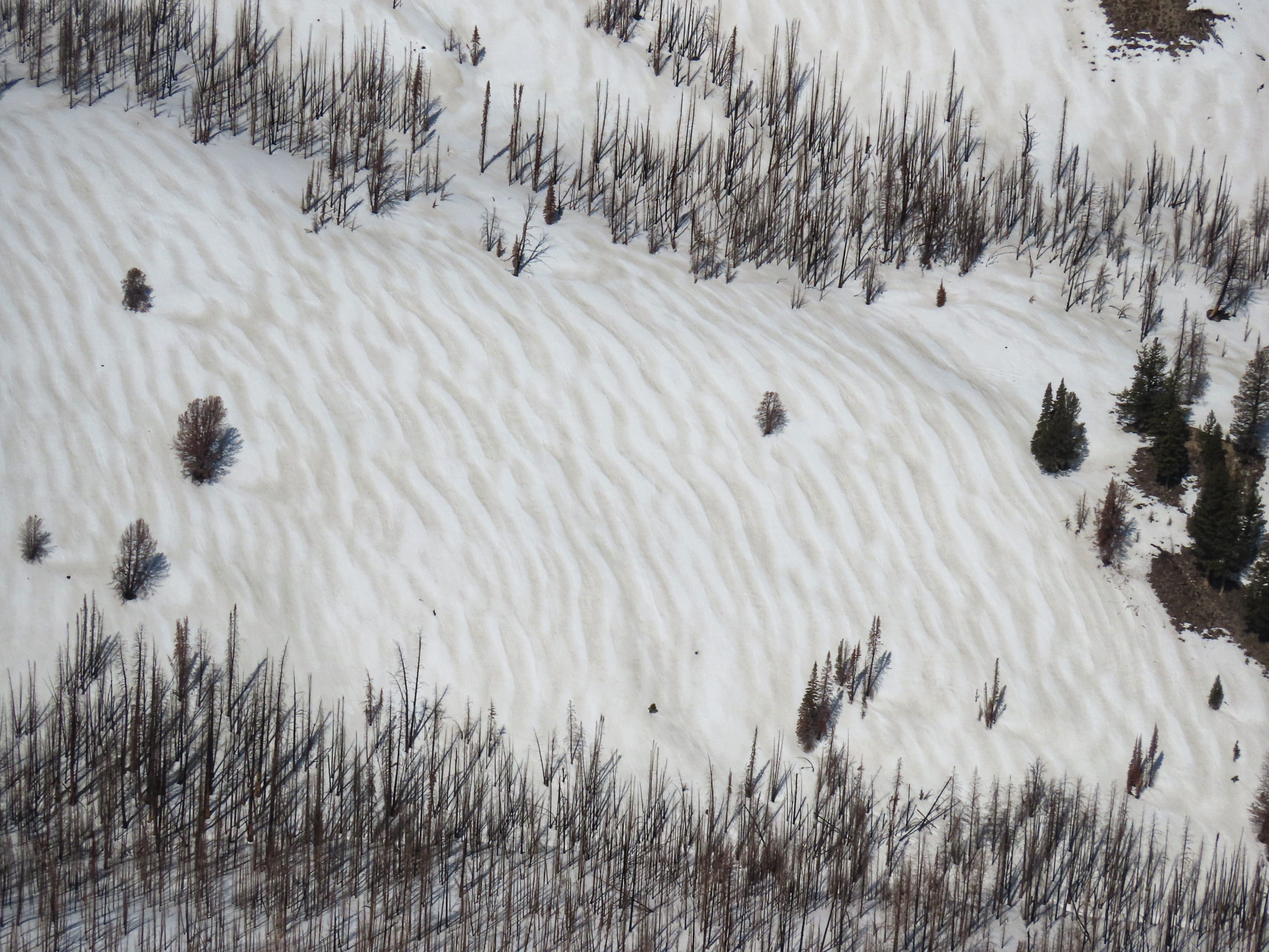
The patterning of the dust in the image above is a result of strong winds moving the dust in the immediate aftermath of its deposition. Originally, the darker sections were raised dunes and the lighter sections were troughs between. Perferential melting of the darker, dustier snow has inverted this relationship.
Dust has a significant effect on how the snowpack melts. The dust is much darker than the snow, which allows it to absorb more radiation and to heat up faster. This accelerates the melting in areas with dust at the snow surface. This effect can be dramatic. The dust also tends to increase the surface roughness as it melts, which can decrease the corn skiing quality. There really isn’t a lot of good to say about dust events, but they are interesting.
SO….WHERE IS THE GOOD SKIING?
Excellent corn skiing developed last weekend. The windows for good skiing were wide open, and it was much easier to be too early than too late. Windows for good corn narrowed significantly on Tuesday and by Wednesday many slopes skipped the corn step and jumped right to mush. Today’s cold temperatures are allowing the snowpack to drain and refreeze the meltwater that was produced this week, but this process takes time. A bit of new snow falling today may provide for a short interruption of the corn cycle, but this should be minor thanks to the low snow totals.
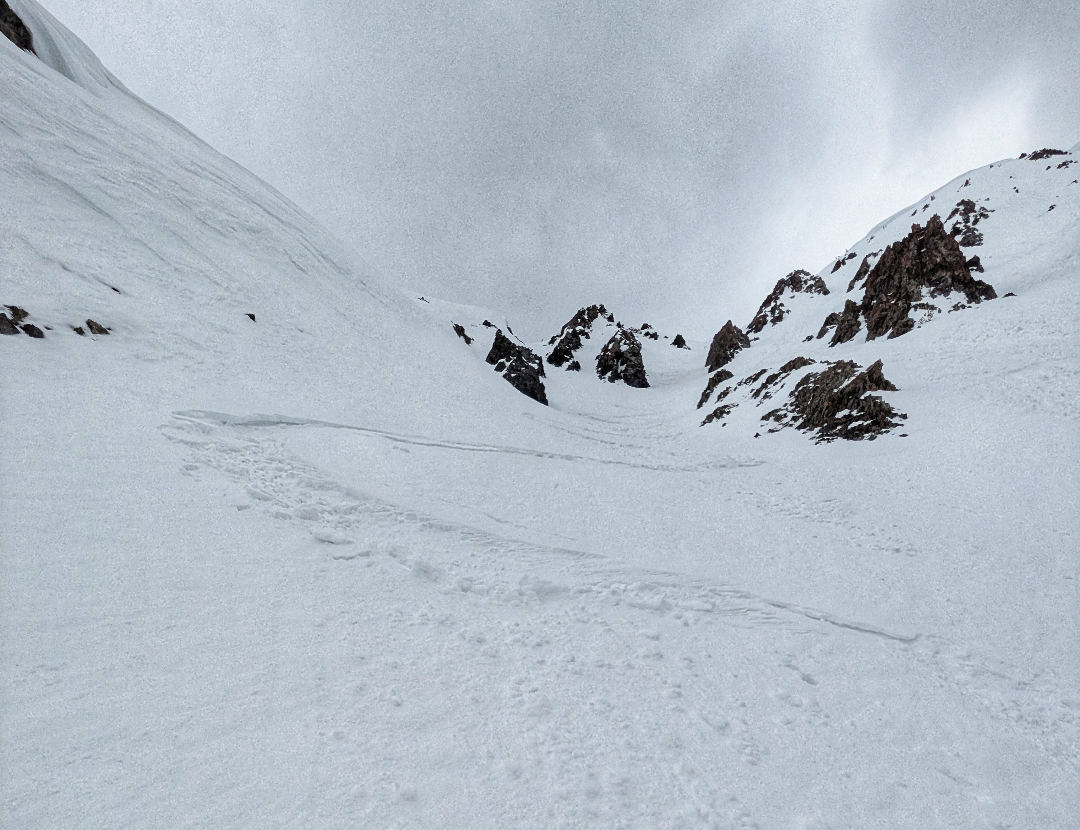
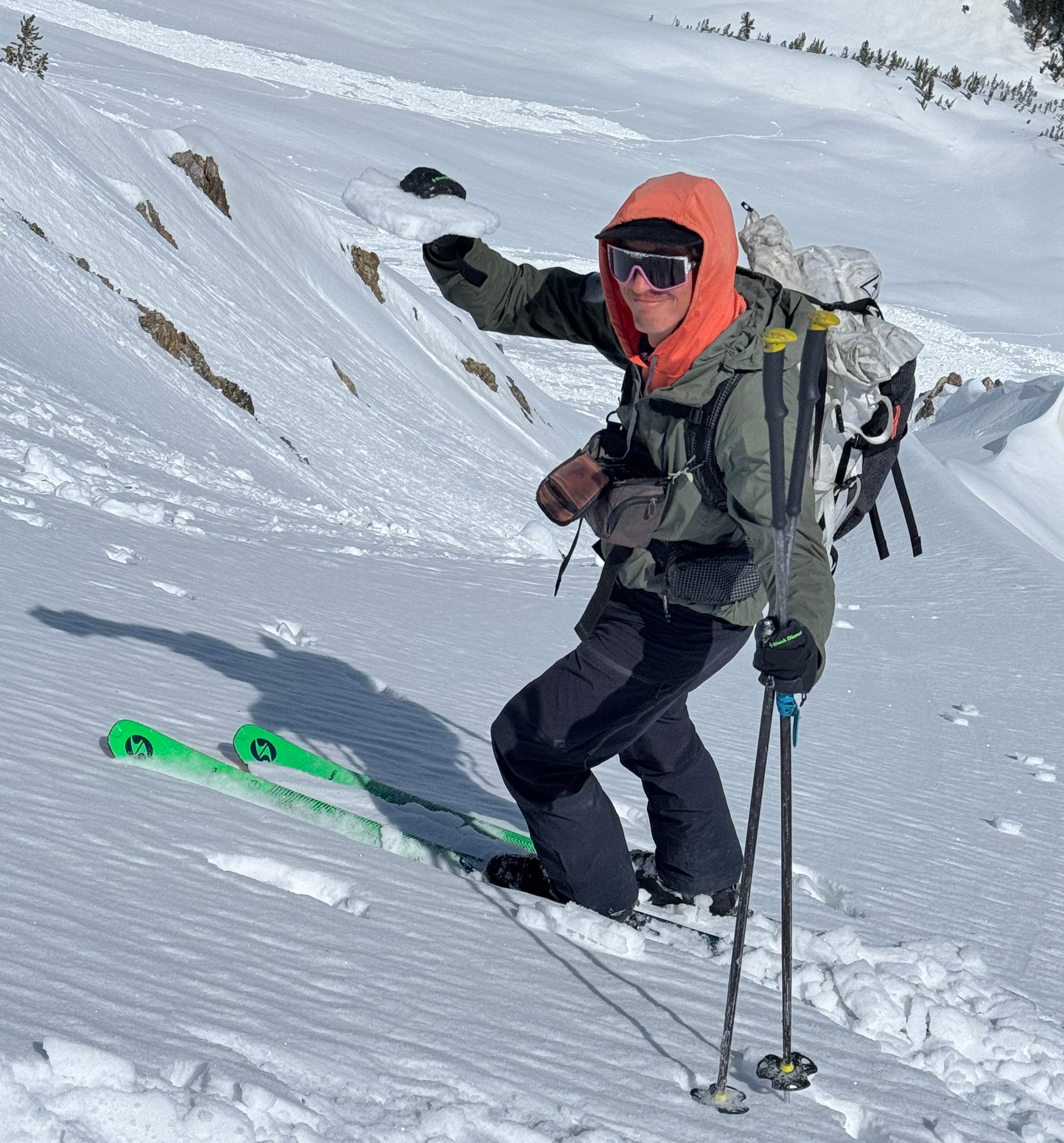
Shaded north aspects were holding excellent skiing until 4/11, when warm air temperatures and heat-trapping clouds allowed for some surface melting to occur. The powder that was on these colder aspects settled significantly and acquired a 2-3cm thick crust at the surface in many locations. It is always a heartbreaker to lose cold snow on the north at this time of year. Here’s a photo of me on 4/13 holding a chunk of the surface crust that formed on shaded aspects, with a recent loose wet avalanche in the background:
Looking forward to the weekend, we appear to be heading for another period of excellent corn skiing. A hard refreeze of the snowpack and cooler daytime highs should make for some great corn on many aspects, with the corn following the sun as it arcs across the sky.
The crusts on shaded norths have been gradually faceting, slightly improving the snow quality there. Today’s brush-by storm is adding an inch or two of snow on top, which should also help improve the ski quality slightly. If it snows more than expected we may have some dry snow issues to worry about (primarily wind slabs), but these should be small and isolated.
Our long bout of good spring skiing and riding should continue this weekend and into next week. At this point it looks like we should get into and stay in a nice melt-freeze cycle during this period, with chances for snow here and there. The pattern remains active but disorganized for the remainder of April. I’m seeing lots of great corn and the potential for some dry snow to refresh surfaces on upper elevation shaded slopes.
It ain’t over ‘til it’s over, and it ain’t over yet.
-Ben VandenBos