
DECEMBER 4th, 2025
A "slow" start to the winter, a look at recent weather, some thoughts about canaries and coal mines, a look at the short and long range weather ahead, and some important questions to ask yourself.

Welcome to December, my friends! Let’s dig right in.
I have intentionally avoided complaining about the “slow” start to the winter…and you won’t catch me complaining today. There are two main reasons for this. First, I am a somewhat superstitious optimist. Second, while snow coverage has been non-existent in the lower elevations, many ranges have been holding and gradually building a snowpack since September or October. This has been particularly true for the high peaks of Idaho, Montana, and Wyoming, where reliable coverage and periodically good turns have existed above ~8,500 feet since October.
I’m not here to lie to you. Snowpack conditions are on the lean side. Many weather stations are reporting snow amounts near or below the minimum for the period of record. (Alright, now we’re talking, setting records baby!) The biggest drivers of snowpack character and distribution in the Western US have been warm temperatures and precipitation falling in the form of rain.
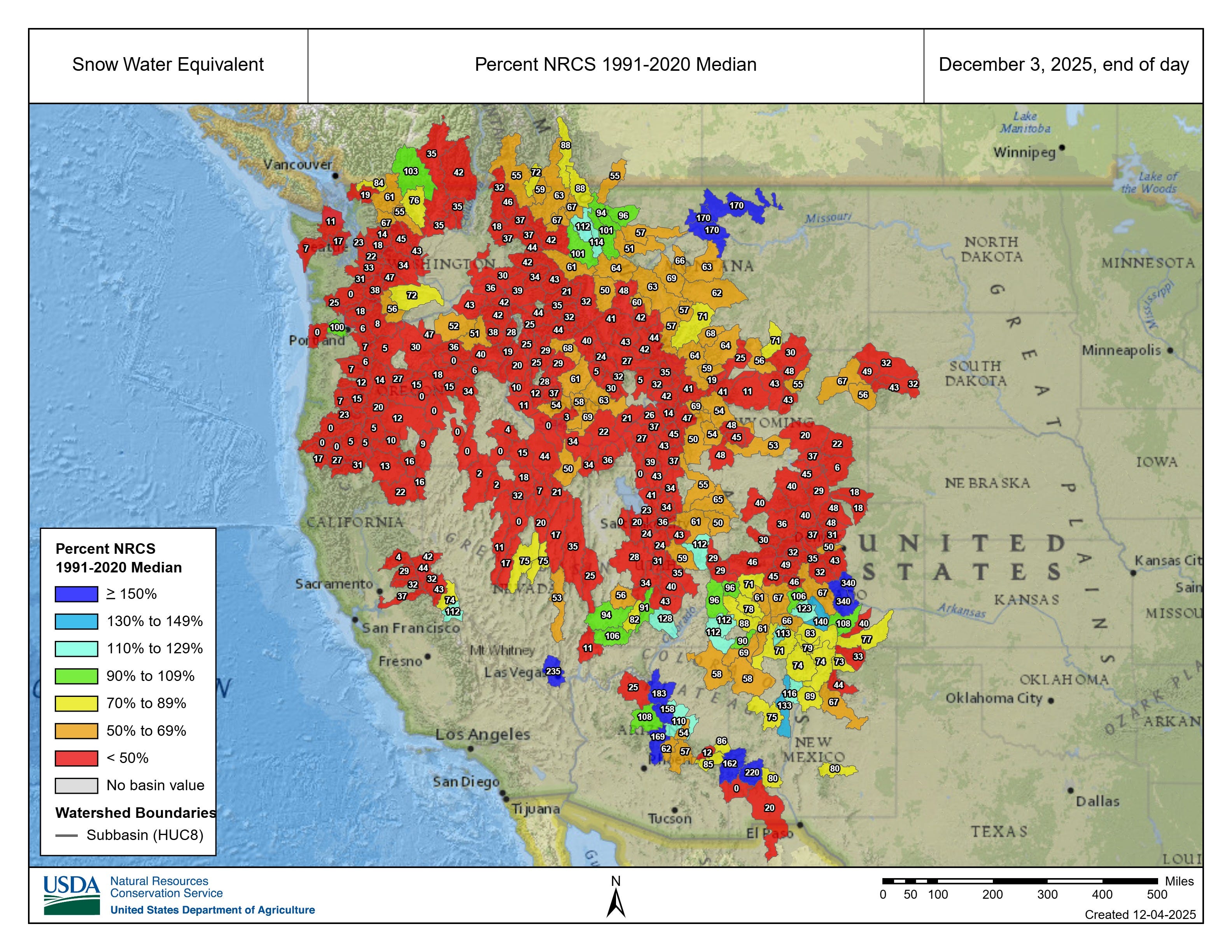
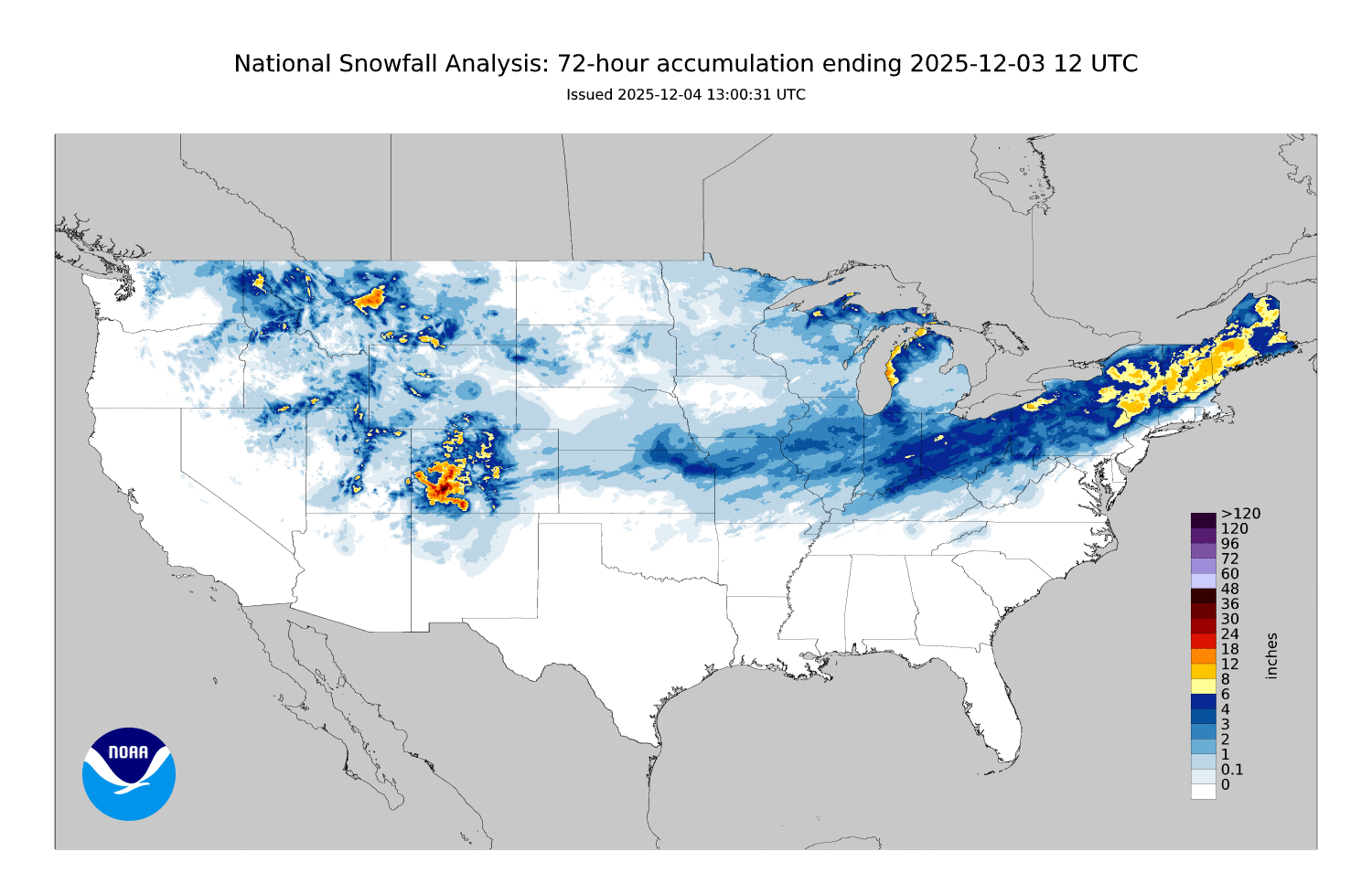
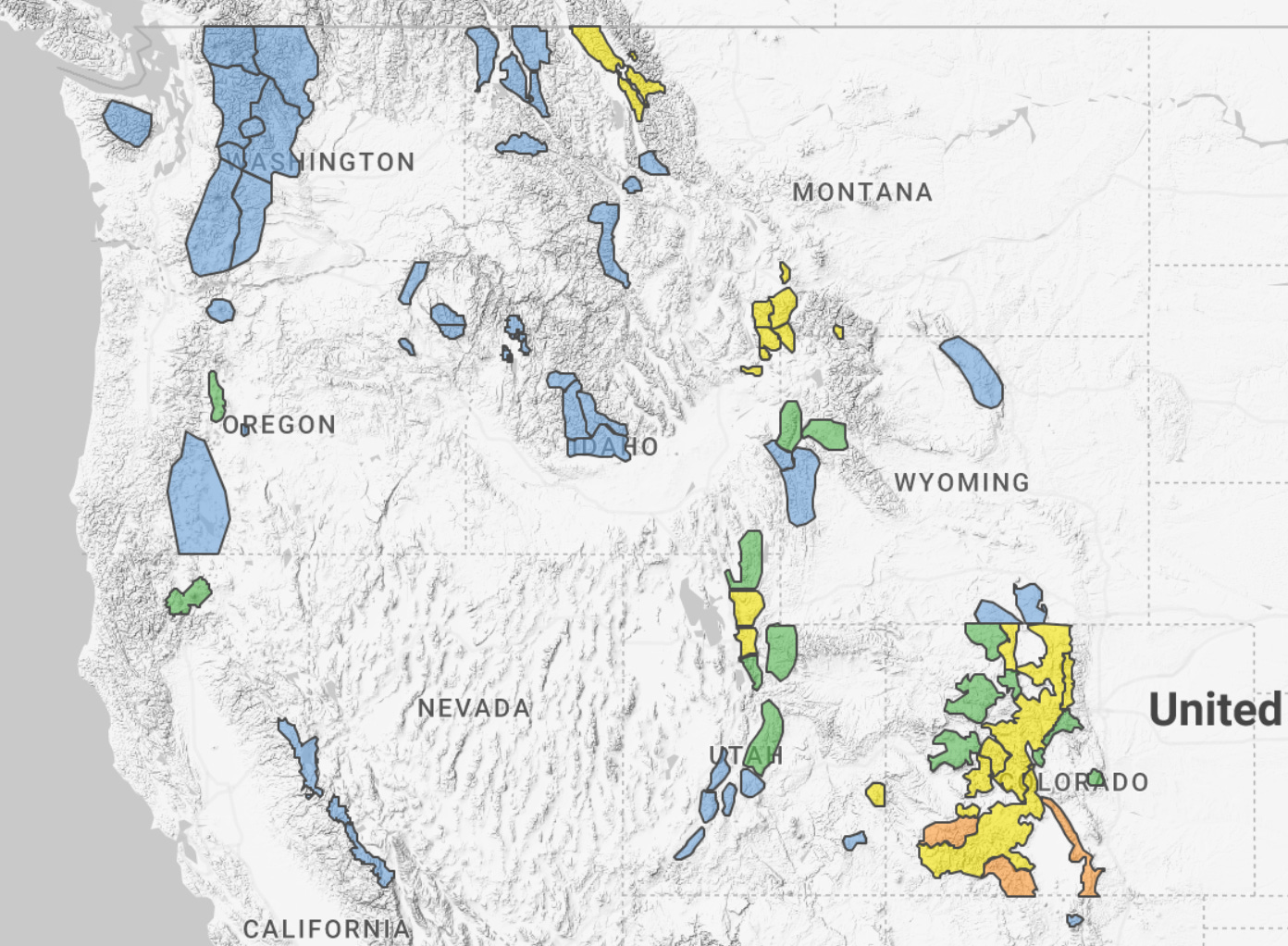
Utah and Colorado saw plenty of precipitation in the early season, but it was too warm for snow. Salt Lake City recorded its wettest October in 151 years of record keeping, tallying 4.95” of water. If this had fallen as snow there would be an impressive low elevation snowpack in the state. Alas, it did not. Look at the map below to see percent of median SWE for basins in the Western US as of this morning. That is a lot of red…
The warm weather left us with lots of snow-free ground on slopes that face the sun, and a variable, complex, often weak snowpack on upper elevation shaded slopes. This snowpack pattern began to be buried in the days leading up to Thanksgiving, when the weather pattern finally shifted. Over the past 2 weeks, rounds of storms have accumulated on top of our early-season weak snow on shaded slopes, and on bare ground on sunny slopes. It is starting to look and feel like winter out there.
RECENT WEATHER
The big picture weather set-up this week had a broad ridge of high pressure parked on the West Coast, and a somewhat stationary blob of low pressure wobbling out north of the Great Lakes. Storms this week have been riding the eastern limb of the high pressure ridge, bringing rounds of moisture to broad areas of the Rockies on a NW flow. None of these storms have been huge, but most have produced snow for Northern Idaho, Montana, Wyoming, Colorado, Utah, and New Mexico. Stronger bands of snow showers brought quick accumulations approaching or exceeding a foot in favored areas, with broad totals over the period approaching or exceeding two feet.
This past weekend, the Canadian low deepened and broadened significantly, allowing for cold air to spill across the central and eastern portions of the US. Temperatures plummeted for the first time this season, dropping well below zero F in places. The panhandles of Texas and Oklahoma even saw some snow flurries with no accumulation. To the west of the ridge, the weather remained mild and dry. The GIF below shows where snow was falling this week:
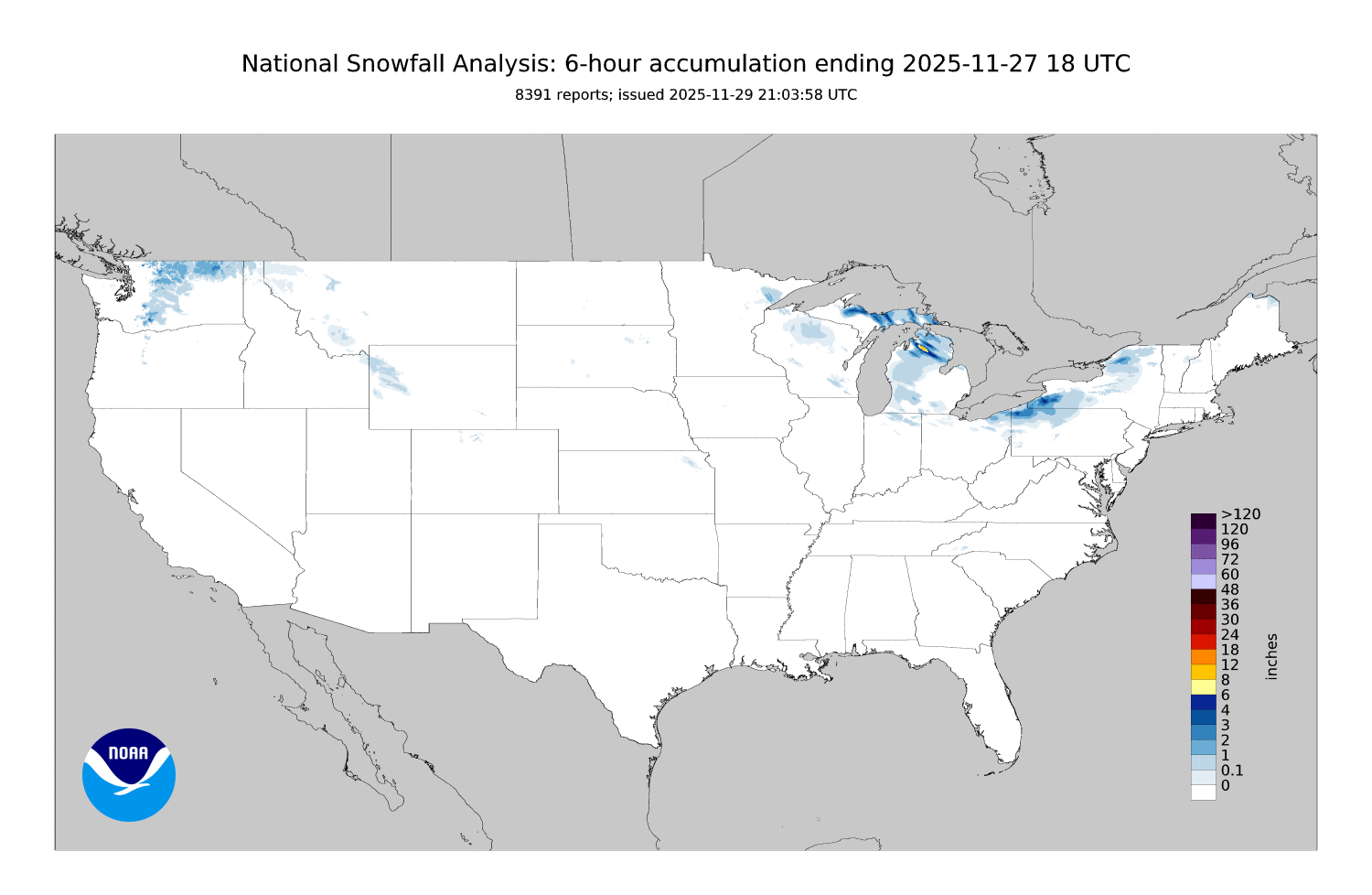
Here is a look at snow accumulations during the first 3 days of December. This does a decent job of broadly painting where snow has been accumulating from our NW flow storms. It also shows the broad swaths of snow showers that have been repeatedly impacting the Northeast and Great Lakes regions. Hmmm, I wonder why there aren’t any colors in California? Sorry, good people.
THE CRACKS ARE SHOWING
Prior to Thanksgiving, Colorado and Utah had mostly dry mountains with weak snow on upper elevation shaded slopes. An extended period of small storms has changed this picture. Add in a clear day after storms, sprinkle in some humans, and the weak snow that developed was grumbling.
On Monday, December 1st, skiers north of Silverton remotely triggered five D1 slab avalanches. You can read their observation here, and read an observation from the same day and same area from CAIC Forecaster Krista Beyer here. Krista has a cool video of an extended column failing on isolation (ECTPV) in her observation from that day.
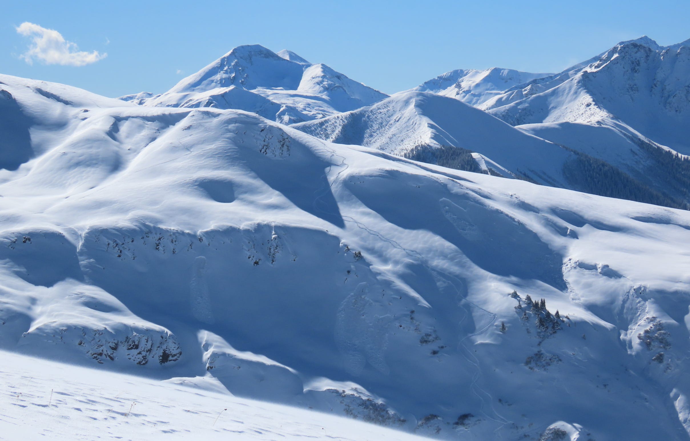
The same day, and just a few miles away, skiers remotely triggered the larger slab pictured below. Forecasters at the CAIC described this as the largest human-triggered slide observed yet this season.
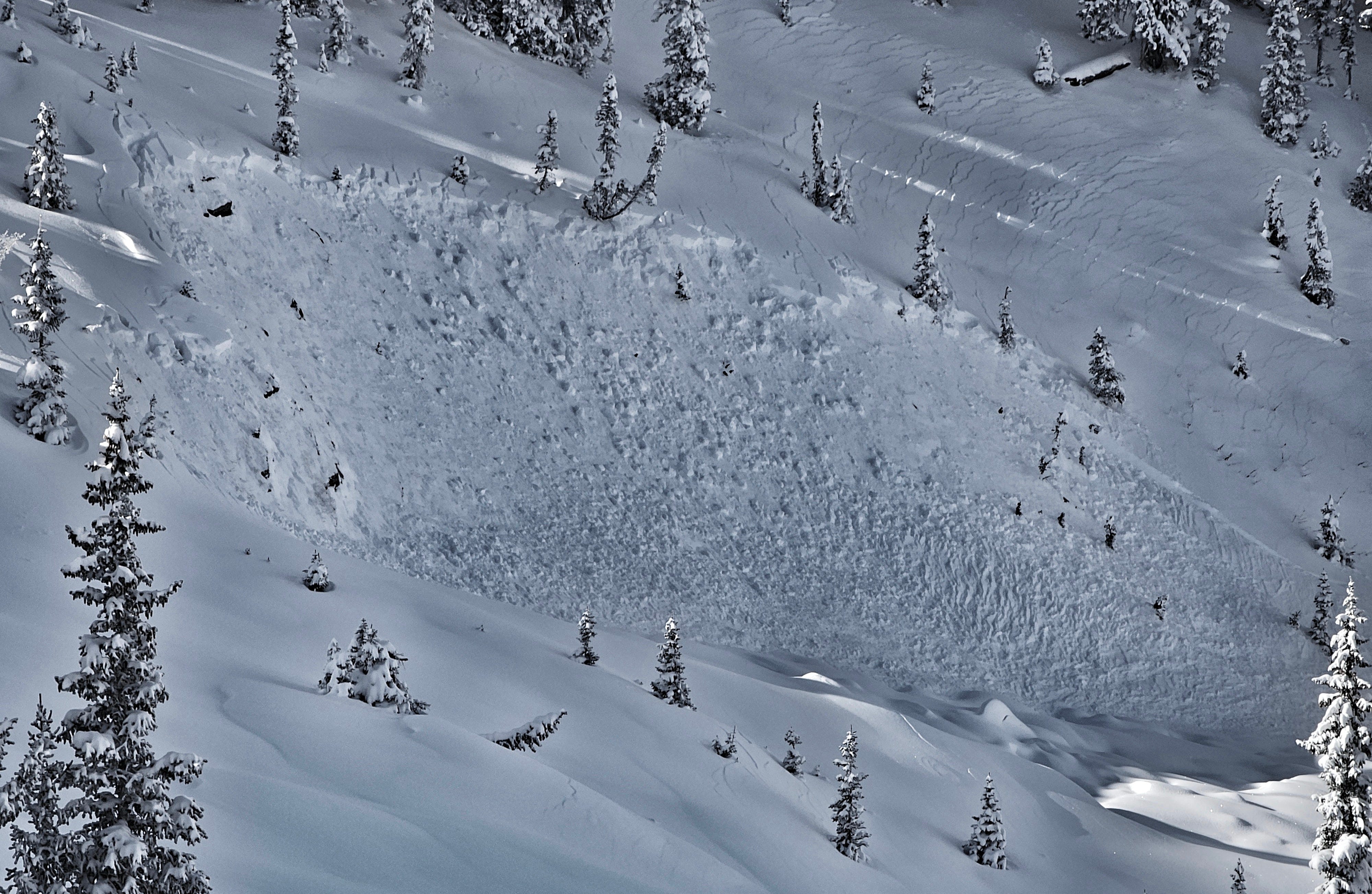
The same day, in central Colorado, CAIC Forecaster Dylan Craaybeek observed a number of small avalanches that failed at the base of the recently accumulated snow. The awesome photo below from Dylan shows one of these slides, and some really interesting cracking patterns in the snow adjacent to the slide. How did these get there? Can you envision what the snow did in order to look like this?
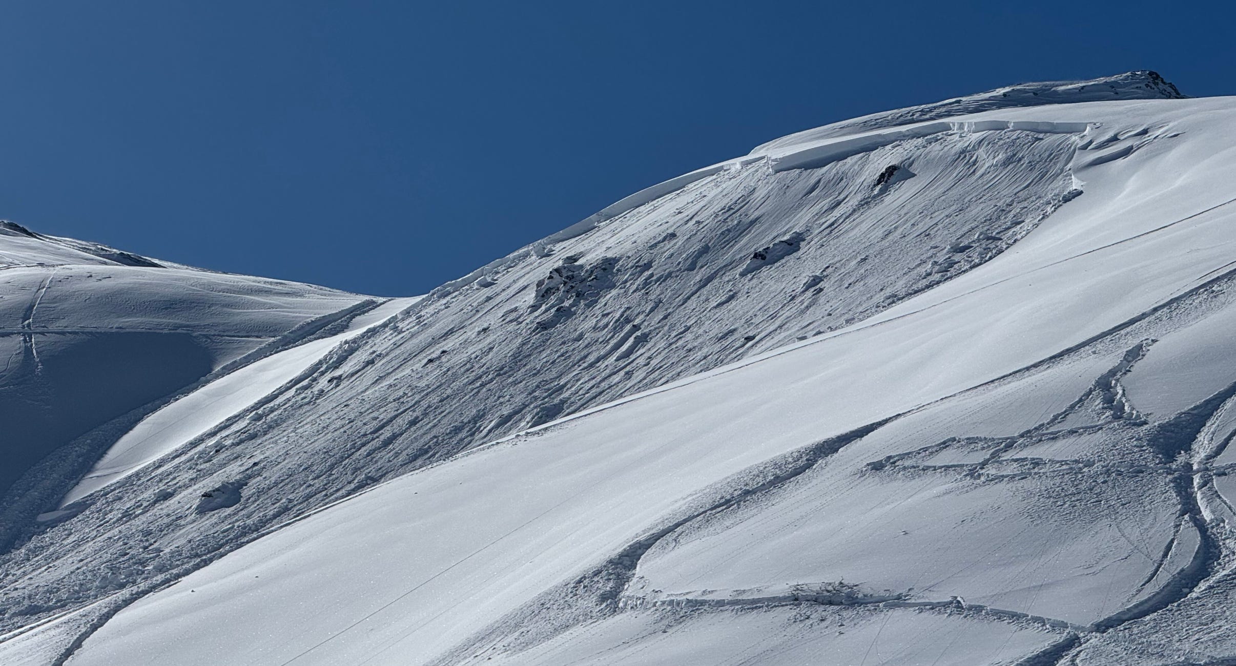
Still the same day, and a bit further west, UAC Forecasters Eric Trenbeath and Dave Garcia were out in the La Sal Mountains where they spotted the natural avalanche pictured below. They probed the debris and found depths over 5’ in places. Their submitted observation from the day does a great job of documenting recent weather and snow conditions in the area. Give it a read here.

Further north in Utah, at least one wildlife-triggered avalanche was reported this week. The code for an animal-triggered slide is AW, which works for both wild and domesticated animals (but not skiers). You can find these codes and so much more in SWAG (Snow, Weather, and Avalanche Guidelines). Note, if you don’t have a copy of this, you oughta order one today. You can find a digital copy and a link to purchase a physical copy here. Follow this link for a photo of a coyote-triggered avalanche at Alta.
Zooming out, these slides are painting a picture of an unstable future. These are the canaries in our coal mine. Natural and human-triggered avalanches following small loads and involving very soft slabs are “great” signs of instability. This weekend brings heavy precipitation, warmer temperatures, and stronger winds to some of these same areas.
LOOKING AHEAD
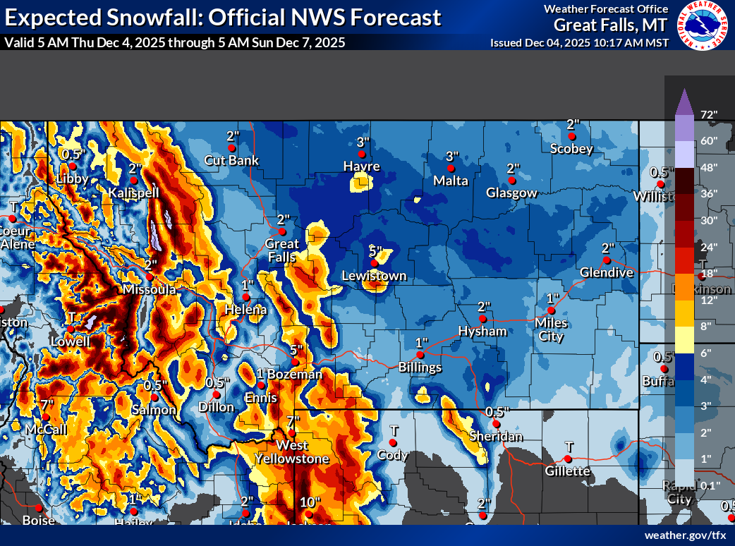
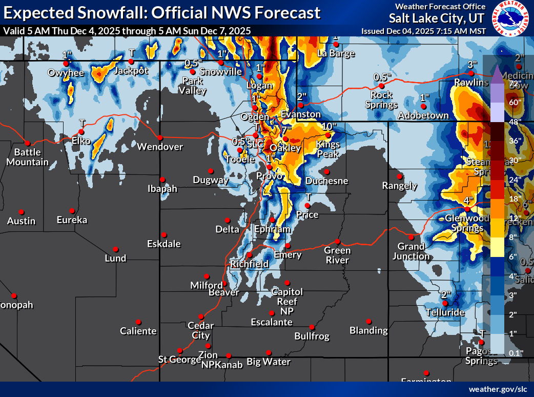
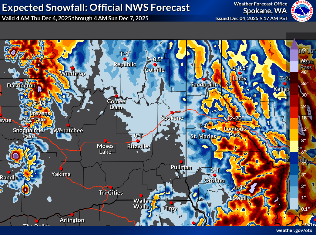
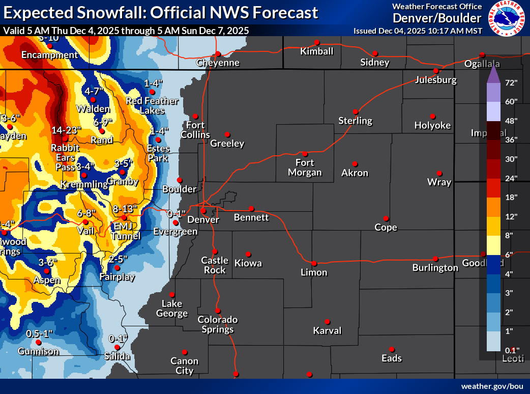
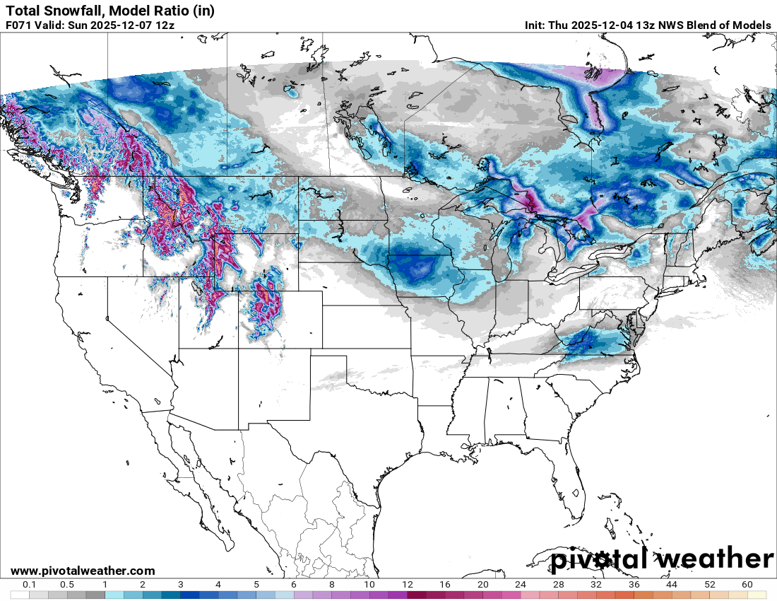
The West Coast ridge is flattening a bit and shifting south this morning, allowing for significant amounts of moisture to hit the northern portion of the West Coast. This moisture follows a similar NW flow (moving from NW to SE), spreading across Idaho, Montana, Wyoming, Utah, and Colorado, delivering big helpings of snow along the way. Unfortunately, we may see temperatures climb during the first major phase of these storms from Friday to Saturday. It is also looking like we will see a hefty dose of wind during a similar time frame. Scroll down to see a few official NWS snowfall forecasts from this morning through Sunday morning to get a sense of what we are dealing with:
MONTANA AND IDAHO from Great Falls Weather Forecast Office:
UTAH, NEVADA, AND WESTERN COLORADO from Salt Lake City Weather Forecast Office:
WASHINGTON, IDAHO, and MONTANA from Spokane Weather Forecast Office:
COLORADO from Denver/Boulder Weather Forecast Office:
Finally, here is a nationwide look at the National Weather Service’s National Blend of Models (NBM), showing snowfall from today (Thursday) through Sunday morning. Remember, this is just a single model run, though it does a good job depicting where snow is expected. Once you get into the peach color, you are looking at 2+ feet of snow.
LOOKING FURTHER AHEAD
Weather models have been struggling with long-range forecasts this fall. But, if you spend a lot of time doing things outside it is always worth being abreast of the forecast. We learn best by watching, and worst by ignoring the world and putting our heads in the sand. So, lets take a look.
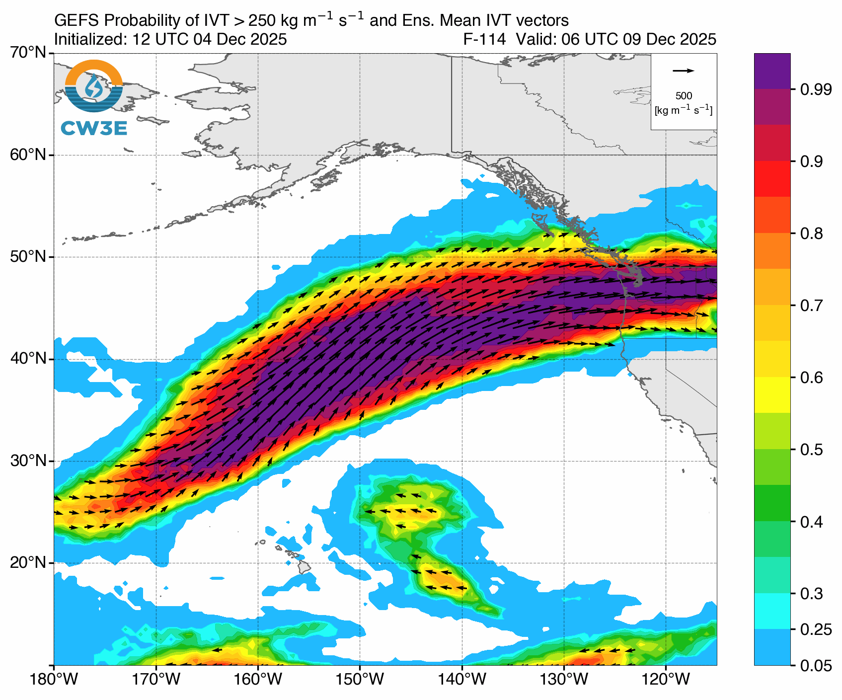
Pulling out my crystal ball, I’m seeing a good chance for some Atmospheric River (AR) moisure to land on the West Coast and move inland early next week. The forecasted AR is arriving further north of some of the earlier AR events this fall, and has a longer tail and longer expected duration. Similar to earlier AR events, it looks like the air will be pretty warm with this: expect to see high snow lines and plenty of rain falling down low. Oof.
The map below shows the probability of Integrated Vapor Transport exceeding 250 kg/ms, based on the Global Ensemble Forecast System (GEFS). Spend a minute orienting yourself here. Find Alaska at the top of the map. Then find Hawaii in the bottom left/center. That is a looong tail of moisture, over 2,000 miles long in this forecast. Wow.
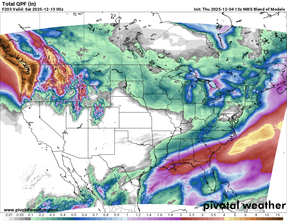
This next graphic shows accumulated precipitation between today and next Saturday (12/4 to 12/13) from a single model run of the NWS National Blend of Models. When you get into the yellow colors, you have exceeded 4” of precip, and the patchy dark browns that you can see along the Canadian and US Coast Ranges appear around 10” of precip. Remember, when you are looking at these coastal areas, a significant amount of this moisture is expected to fall as rain, not snow. Also, this graphic includes the water that will fall over the next few days.
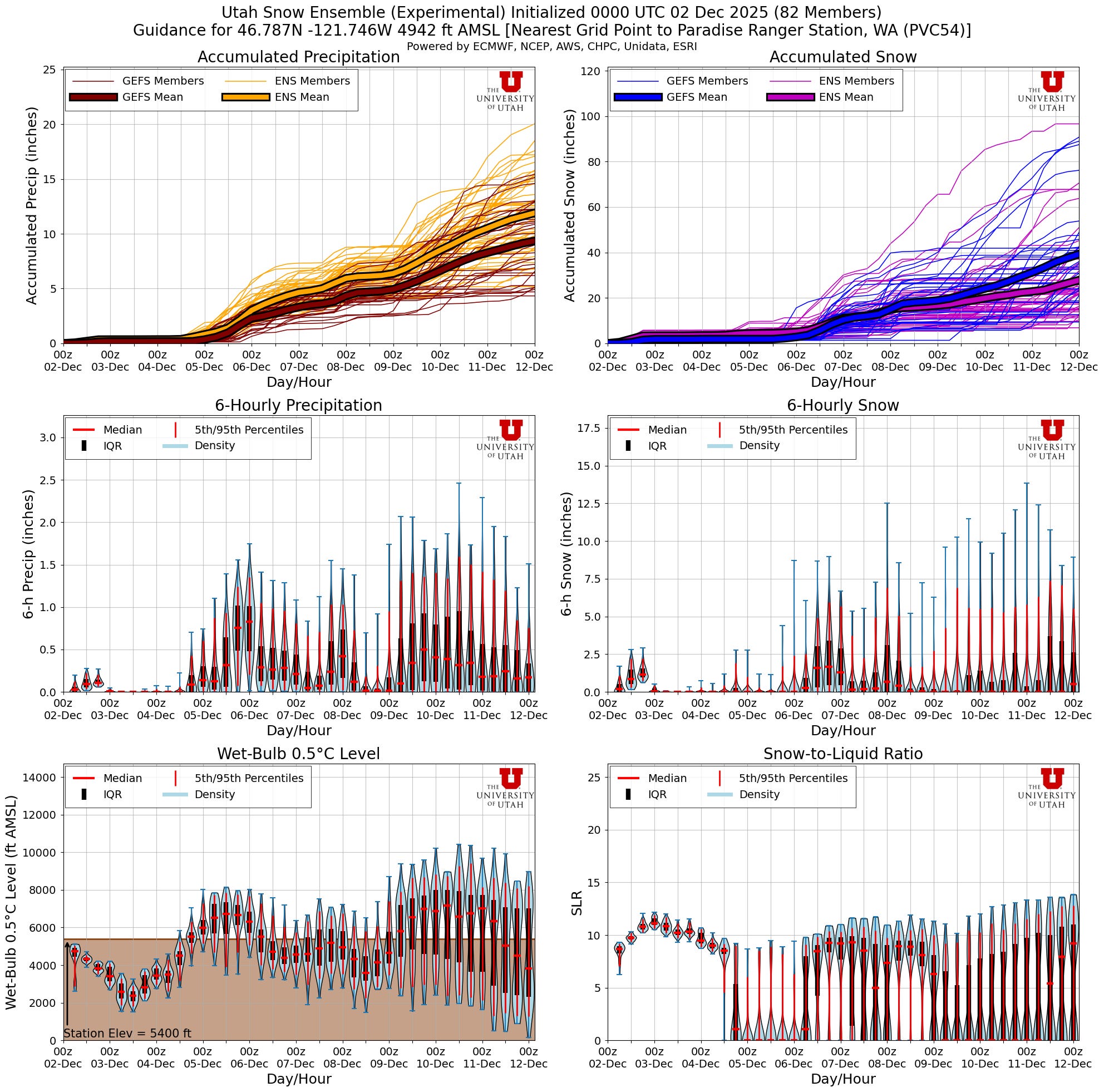
And here’s one more way to peer into the uncertain future that the week may bring. The set of graphs below show ensemble forecast data from the GEFS (described above), and the ENS (roughly, the European version of the GEFS). These data are for the Paradise Ranger Station, just under 5,000’ on Mt. Rainier. The thin lines in the upper two graphs are individual members of the GEFS and ENS, and the thick lines are the averaged solutions.
A QUICK TRIP TO THE SOUTHERN HALF OF THE COMPASS
Speaking very broadly, the areas with enough snow for turns have been the areas most likely to produce avalanches. These are slopes that have been holding snow for weeks, the high, cold ones. However, in the past two weeks, slopes that face towards the sun have begun to accumulate a seasonal snowpack in areas favored by recent storms. Breaks between storms have generated layers of surface hoar, near surface facets, and crusts.
Where precipitation has been frequent and steady, these layers are absent or unremarkable. Where surface hoar deposition was widespread, and where breaks between storms have been longer, these layers are more prominent and potentially concerning. What do they look like in your mountains? Has it snowed enough in the past 2 weeks to smooth out the terrain on solar slopes? Maybe there is even enough snow for some cautious turns?
AVALANCHE FORECASTS
The Central Oregon Avalanche Center, Mount Shasta Avalanche Center, Utah Avalanche Center, Crested Butte Avalanche Center, Flathead Avalanche Center (NW MT), Gallatin National Forest Avalanche Center (SW MT), and Bridger-Teton Avalanche Center (WY and ID) all started issuing Avalanche Forecasts with danger ratings this week.
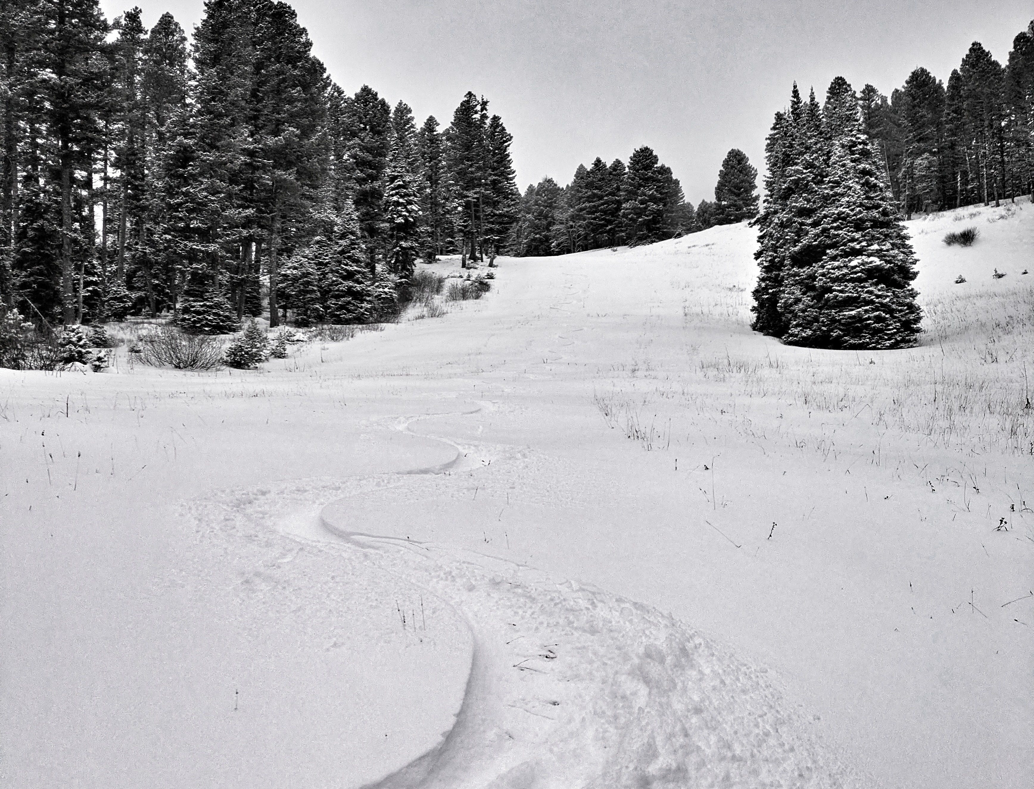
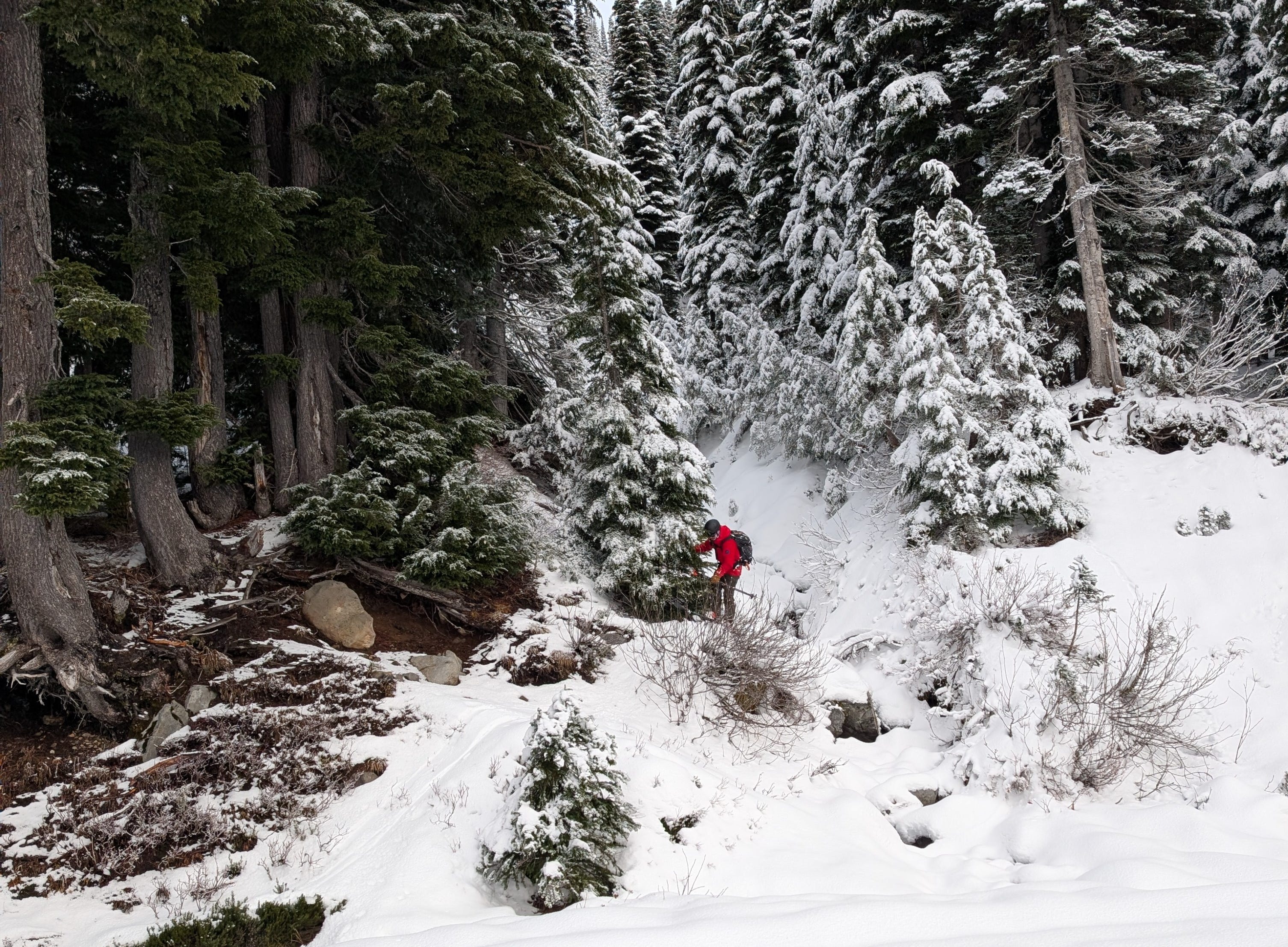
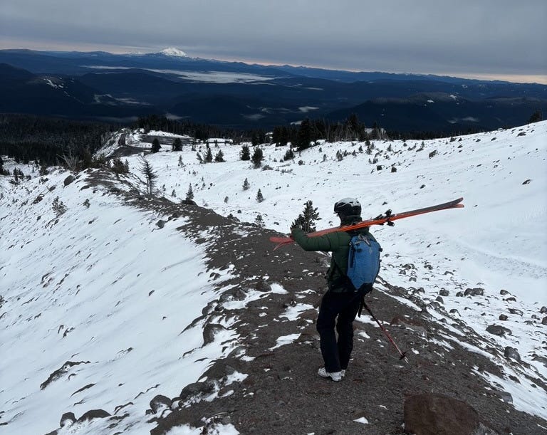
Thanks to all of you for your time dealing with the uniquely snow-free winter. It has been fun to watch what these hard-working guys and gals have been doing in order to collect quality snowpack information. Below are a few photos that illustrate the recent challenges with getting up high enough to look at the snow. The work is not always easy and fashionable, but it is important. Say thanks if you see these guys and gals out in the mountains.
A SET TABLE
We have all of the ingredients in place for human-avalanche interactions this weekend. Lots of weak snow in the mountains, plenty of indicators of how this snow will behave when loaded, and heavy storms in the forecast. Perhaps most importantly, we have many snow-hungry skiers and riders who are itching to get out into the mountains and make turns (myself included).
Have you gone through your backcountry kit this fall? Is it dialed? Have you practiced with your beacon? Like, you actually practiced? Or you just put new batteries in and turned it on? Have you been out in the field watching the snowpack evolve or will this be the first time you encounter it this season? What direction does the slope you are headed to ski face? What do you think the snowpack looks like there? Have you read through local observations and got caught up on the Avalanche Forecast? What is your weather going to do? Is your probe in working order? Are you planning on entering avalanche terrain? Are you and your partners on the same page about that?Phew. This list goes on and on and on…
I don’t raise these questions to judge you. Any judgment I might make of you is immaterial. I’m asking these questions because, if things go sideways, you are the one who has to know what to do. If these questions prick your ego and make you bristle, spend the time it takes to answer them. This is the work of traveling safely in the backcoutry. It is not one-time work, it is a lifetime of training and re-learning.
Enjoy the long-awaited return of winter. Frolic in the snow, come back home drenched. Or dry. Or tired, or cold, or ready for more. Most importantly, come back home with everybody you started with.
I’ll see you next week.
-Ben VandenBos