
FEBRUARY 6, 2026
Short-lived cold is followed by record-setting warmth; dry, damp, and wet loose avalanches; a slab builds over the January drought layer; some thoughts on practicing mindset shifts; and a look ahead.

Note: I’m coming at you a day late this week and extra sun-tanned. I had a good friend visiting and we were playing on the weather’s schedule. Thanks for your patience.
WEATHER
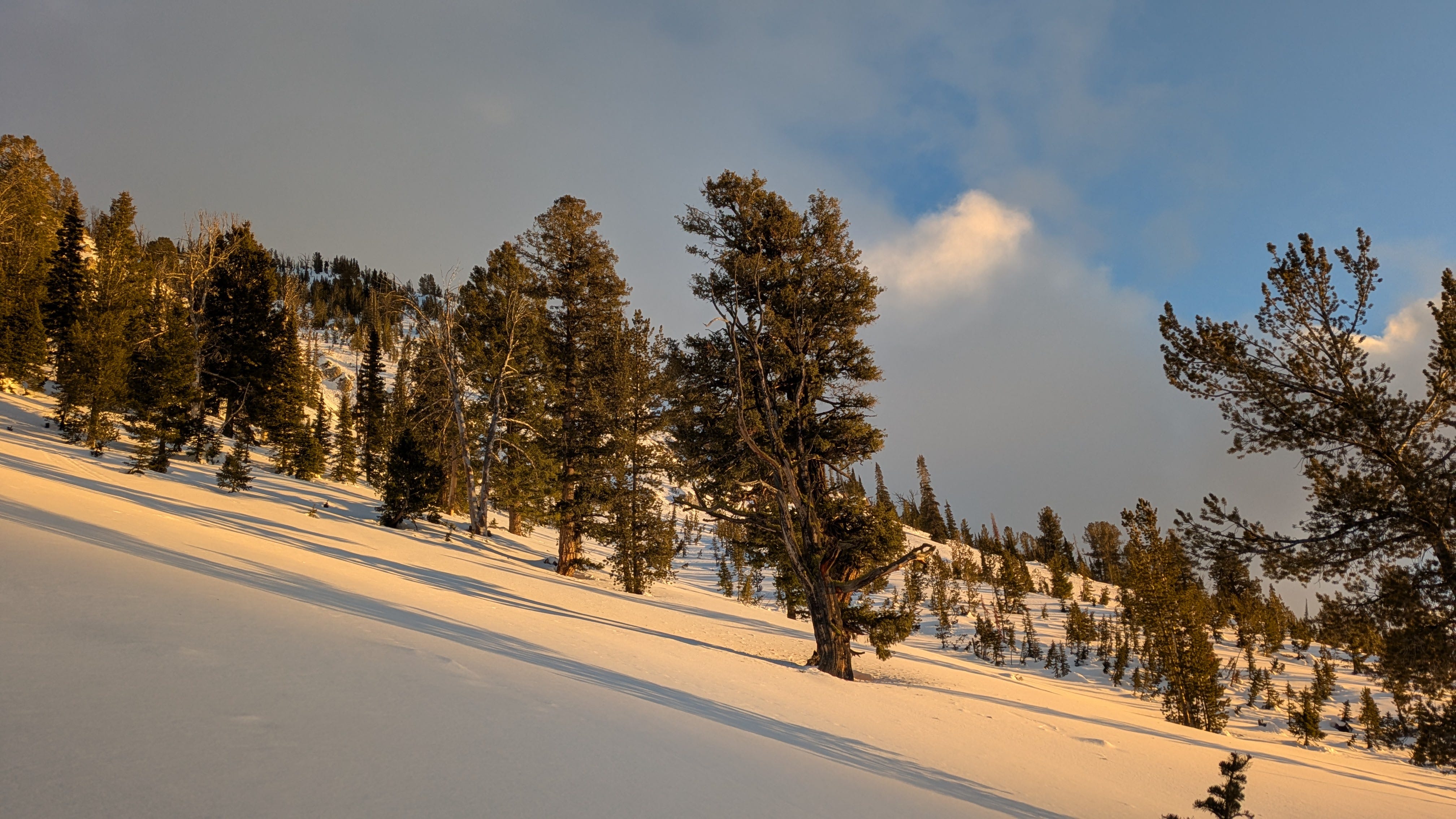
We have turned a corner, passing the midpoint between the hibernal solstice and the vernal equinox. The days are still relatively short, and the sun still relatively low in the sky, but it’s a different world than you’ll find in deep winter. The snow is changing, always changing, sometimes by infinitesimal increments and sometimes by leaps and bounds. Our job is to guess how it will change, watch how it actually changes, and repeat.
The month of January brought an extended drought to the Western US, thanks to an unfortunately persistent ridge of high pressure. Temperatures were warm initially, but a deep buckle in the jet stream allowed for large amounts of cold air to pour south off the Canadian Shield. Find below a cool graphic from the good folks at NASA’s Earth Observatory showing cold temperatures making their way into the US during the final week and a half of January:
Despite the lack of snowfall, these cold temperatures brought at least a little flavor of winter to the overwarm, snow-starved West. They also created some excellent facet-forming weather. Strong daily temperature swings, coupled with plenty of direct sunshine and open-skied nights significantly weakened snow surfaces. This process had been occurring throughout much of January, but colder temps kicked things into high gear.
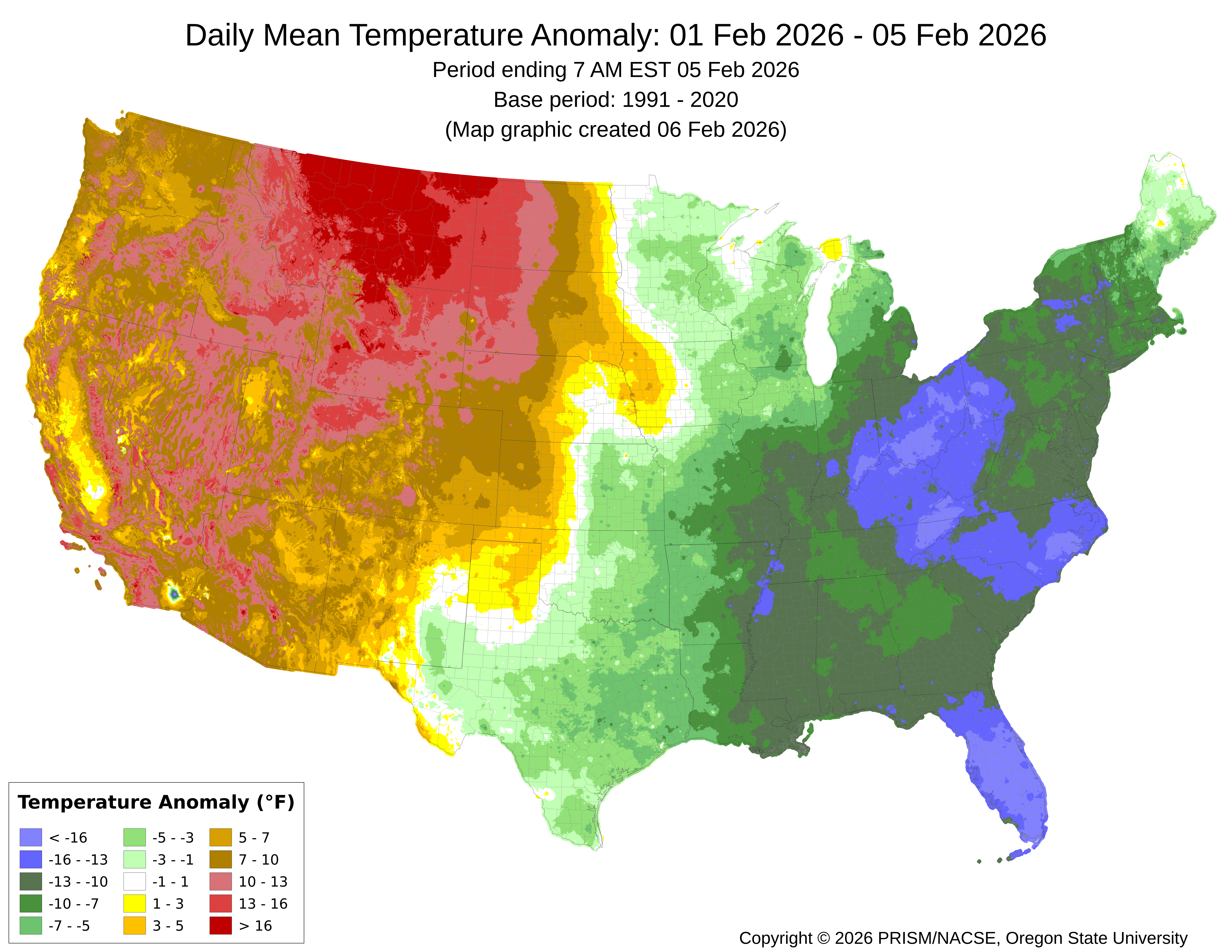
Of course, it’s 2025-26, the season without a winter, and the heat had to come back. Beginning this week, temperatures have climbed significantly. In many locations, upper elevation terrain has remained above freezing overnight for a few days already. Lower elevation temperatures are climbing into the 60s and 70s F, with some mountain locations recording temperatures approaching 60 degrees. Yuck. The map below shows the daily mean temperature anomaly for the first 5 days of February. The warm colors are above average temperatures, and once you get into the red colors, you are looking at 10+ degrees Fahrenheit above average:
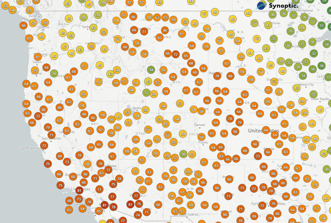
To hammer the point home, here’s a look at temperatures across the West yesterday afternoon:
A LONG DROUGHT ENDS
We’ve all been dealing with the extended January drought. A ferocious ridge deflected nearly all moisture away from the Western US, pushing it well to our north or south. Over the past two weeks, snowfall has returned to portions of the West, though snowfall amounts have been meager.
Year of the drought and year of the rain crust. That doesn’t sound like the best recipe for quality ski conditions to me. But we don’t get to choose our snowpack conditions; we just get to decide how to play the hand we’ve been dealt.
After weeks of waiting, the signals of a changing pattern are drawing closer and closer. At this point, we aren’t looking at massive, extended storms, but there is high confidence that the blocking ridge parked on the Western US will break down. I’m not seeing any signal that the ridge will rebuild in the short term, though the overall pattern is pretty disorganized. More on this further down.
AVALANCHES
Human-involved avalache activity this week has fallen into two categories:
Dry and wet sluffs, often involving weak, faceted snow.
Thin, relatively hard slabs failing on top of similarly weak, faceted snow or surface hoar.
We touched on the idea of dry loose facet sluffs last week. Briefly, once the faceting process has advanced beyond a certain point, snow becomes so weak and granular that it wants to move down the mountain if you give it a push. These slides are similar to dry loose slides involving new snow, but they can be a bit more surprising and can pack a serious punch, thanks to the density of the facets. Individual facet sluffs can be hazardous in and of themselves, but the more pressing concern is how a pile of facets that can barely prevent itself from falling down the hill will behave when a sizable slab is applied…

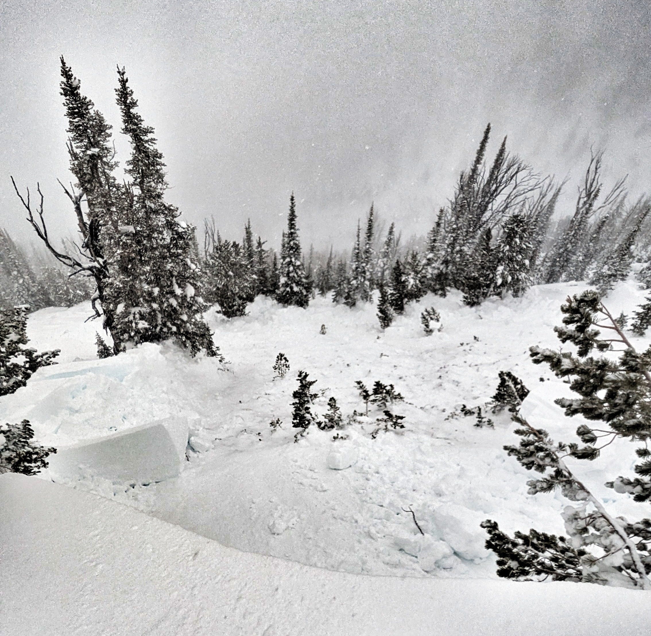
On Saturday, January 31, a skier in Big Cottonwood Canyon, UT, experienced two close calls involving dry facet sluffs. First, they triggered a sluff that hit a party below. Then, when descending the slope, the skier triggered and was caught and carried 300 feet down the slope by a sluff they triggered. The image below shows these slides (quality is not great):
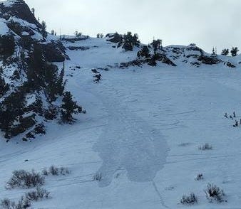
It is sooo easy to look at this and say to yourself, “I would never do that.” If you choose to follow this route, I promise you that you are short-circuiting your learning process. If you choose to believe that you are somehow incapable of making mistakes, you render yourself unable to learn the lessons that near-misses provide. Fortunately, the skier who triggered these slides chose the harder path of admitting their mistakes, identifying those mistakes, and trying to learn from them.
Their submitted observation starts with the line, “I made a few poor decisions today….” This honesty is a crucial portion of the learning process. Too many almost-accidents and near-misses get pushed into the dustbins of our memories by a combination of shame, pride, and self-righteousness. Don’t make this mistake. Pack your judgment away, and go read this observation. Thanks for your honesty, Joe.
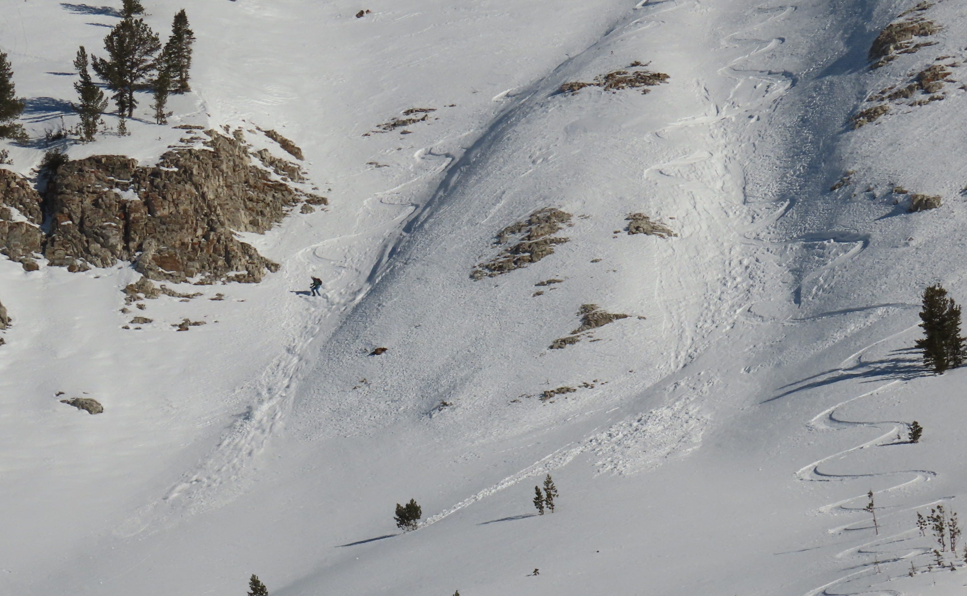
In addition to dry loose facet sluffs, we started to see some mixed-character facet sluffs on slopes on the E and W side of the compass, thanks to the heat (photo above). These solar margins don’t get much energy from the sun during the depths of winter, but as we head towards spring the amount of radiation received here increases by the day. Slopes that were holding dry facets with either a thin sun crust or no crust at all are being increasingly cooked.
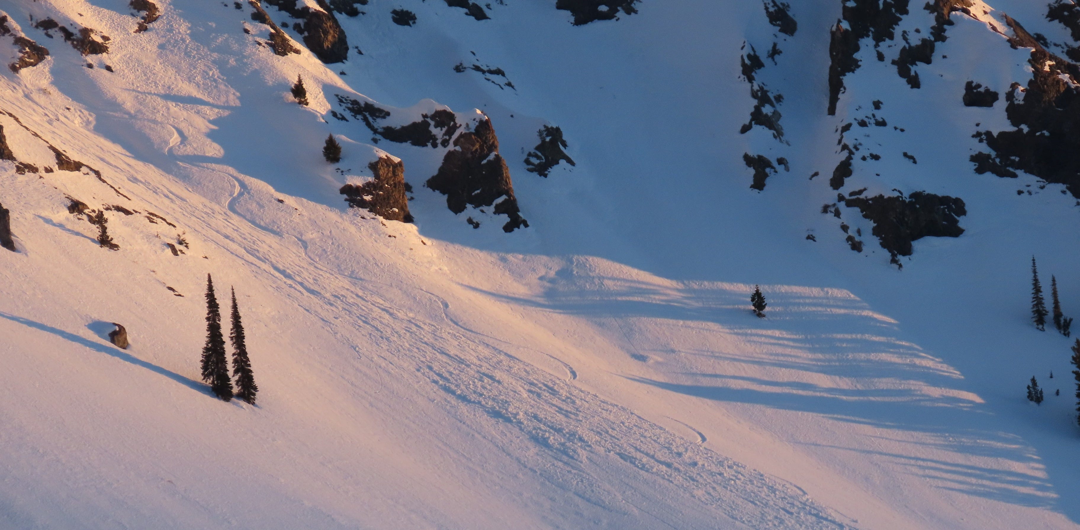
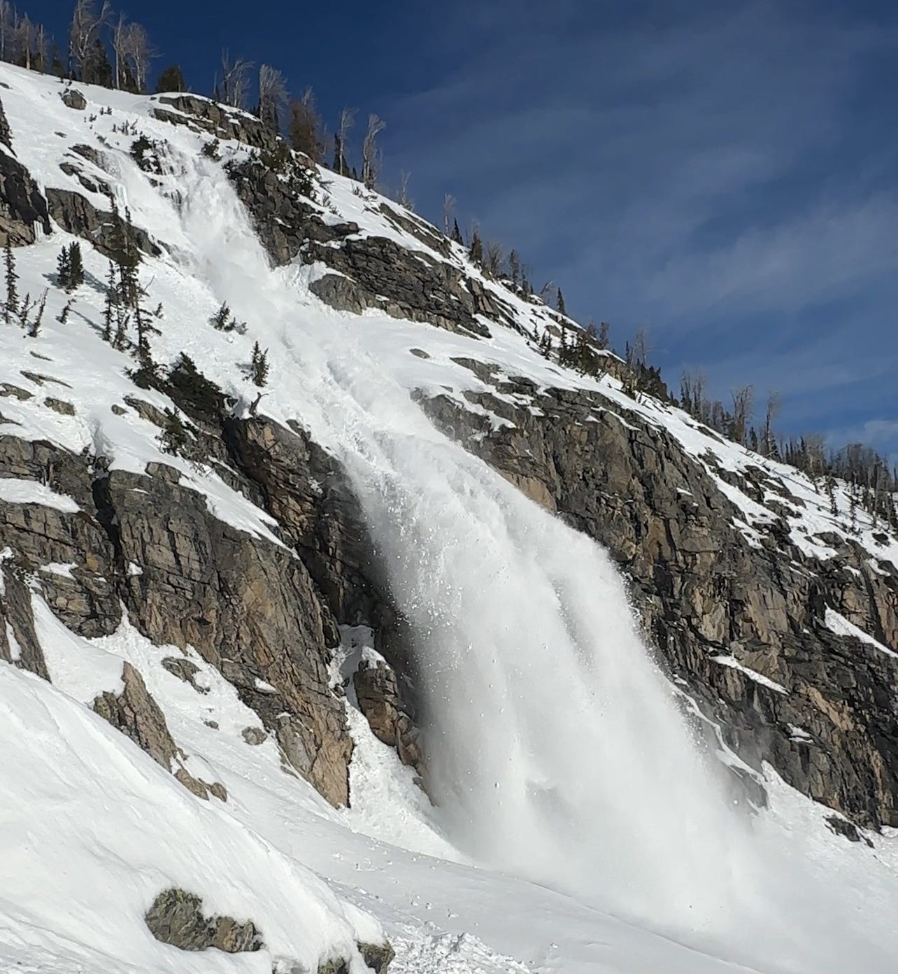
Details are limited, but the photo below shows a large wet avalanche cascading down a SE aspect in the Tetons yesterday. The party described this slide as a D2 wet slab. The photo makes it clear that this is not the type of slide you’d want to be caught and carried in.
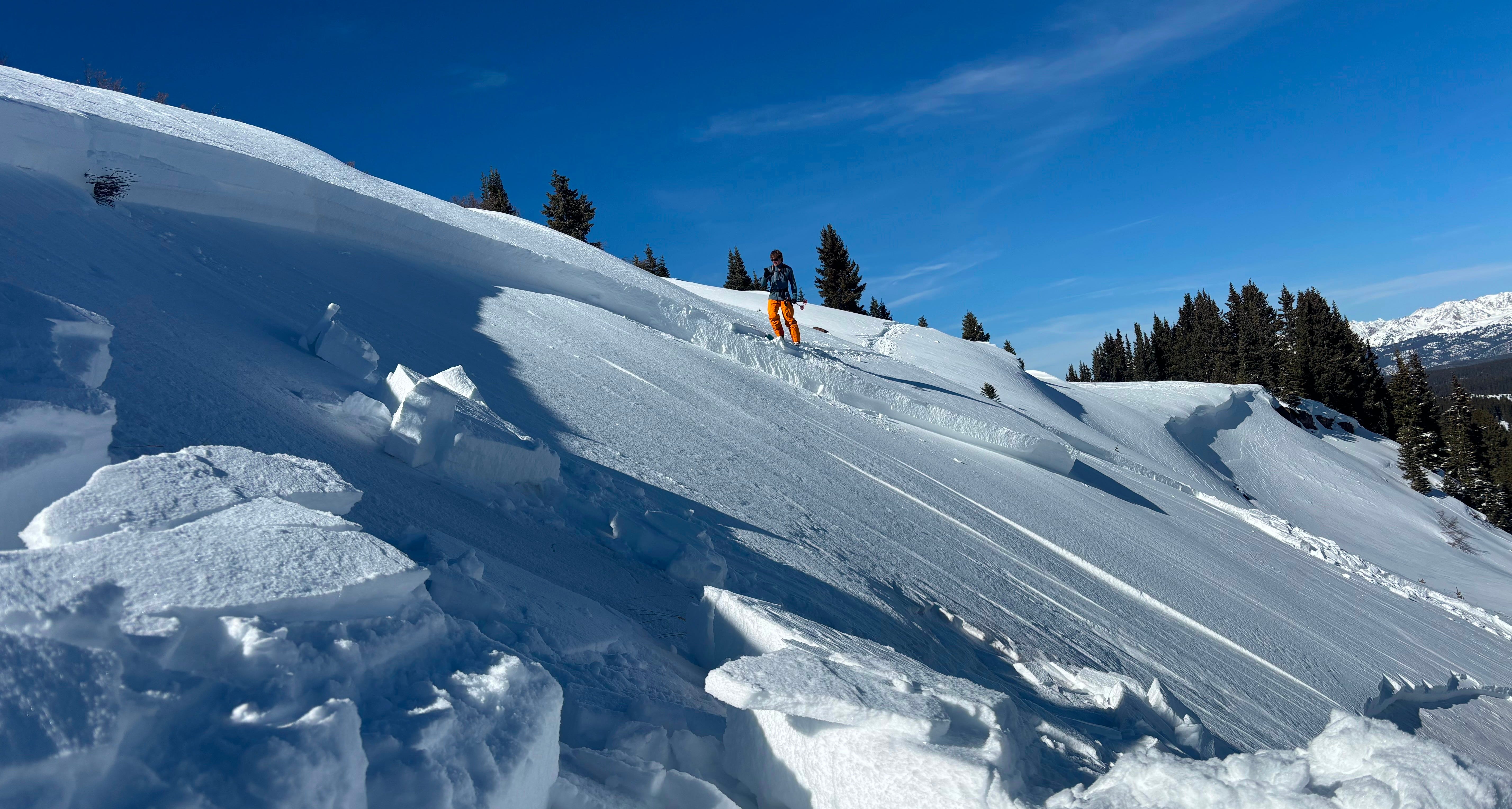
The facet sluffs described above could definitely ruin your day, but our eyes are beginning to drift towards the future. The very weak snow surfaces that have been building for a month will serve as a terrible base for future snowfall. A few areas in Utah and Colorado have seen enough snow during recent minor storms to build a slab over the January drought surface. In these areas, conditions quickly became dangerous. Take a look at the three photos below, all involving wind-drifted slabs that failed on the weak facets:
In Northern Idaho and Northwest Montana, the mountains are generally lower, temperatures are warmer, and the faceting process has been slower and less severe. Unfortunately, a hearty layer of surface hoar was buried at this same interface. As a slab was formed with minor storms last week, it quickly became clear that this surface hoar layer was going to be a problem.
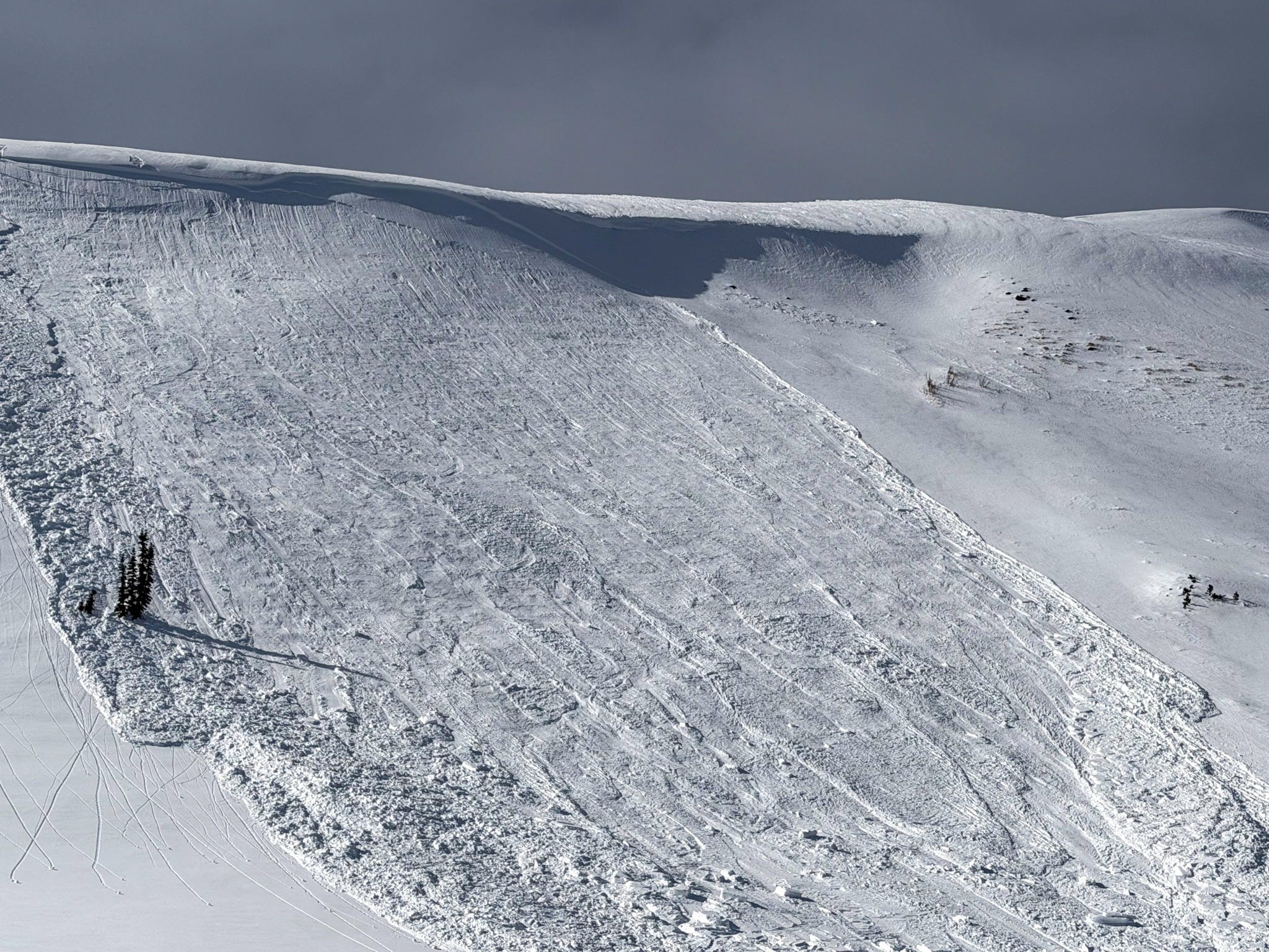
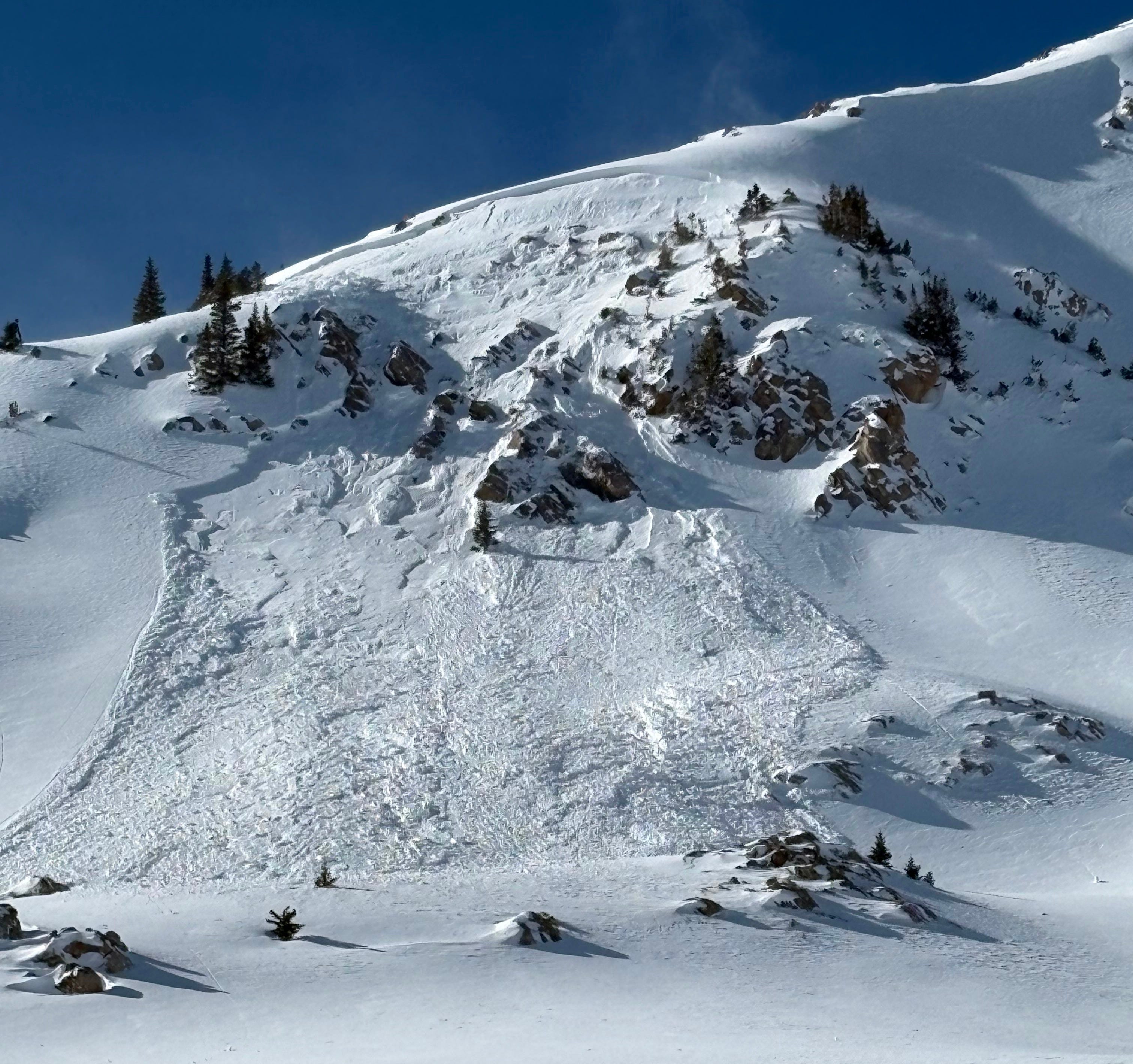
On Wednesday, a Forecaster at the Flathead Avalanche Center intentionally triggered a large slab avalanche that failed on this surface hoar. The slide broke 1000 feet wide and ran downslope 700 feet. A portion of the crown is visible in the photo below:

These persistent slab avalanches are canaries in our coal mine. They aren’t outliers; they are leading indicators. As the forever ridge shows signs of breaking down, and snowflakes begin to appear on our weather apps, it is time to pay close attention and heed their warnings.
PRACTICING THE MINDSET SHIFT
The idea of strategic mindsets was first introduced into the professional snow world in a seminal paper written by Roger Atkins. This work, titled “Yin, Yang, and You, was presented at ISSW 2014 in Banff. If this work is new to you, I highly recommend you read this. If you’ve already read it, think about going back and giving it another read. I suspect you’ll find at least a few tidbits that you’d forgotten about.
Atkins defines mindset this way:
Our mind-set consists of a collection of attitudes encompassing our perception of the avalanche hazard and the desires that we hope to satisfy. This mind-set is the context in which automatic processes produce responses aimed at satisfying our desires while avoiding the consequences posed by the hazard. It is our mind-set that defines our perception of terrain and conditions, where it is desirable to travel and where the risks are.
I won’t dive deeply into this concept, but I’d like to spend a minute thinking about mindset and how much our collective mindsets will need to shift as we head into a period of changing conditions.
Here in central Idaho, avalanche danger was solidly LOW throughout the latter half of January. Good stability, good coverage, and turns of all flavors. That has been changing slightly this week as dry loose facet sluffs and wet snow problems reared their heads, but these problems have been small and manageable. Nothing like the mid-winter persistent slab problems that we are used to dealing with. It has been remarkable how quickly the widespread avalanche cycles from earlier in the winter can fade into the background…
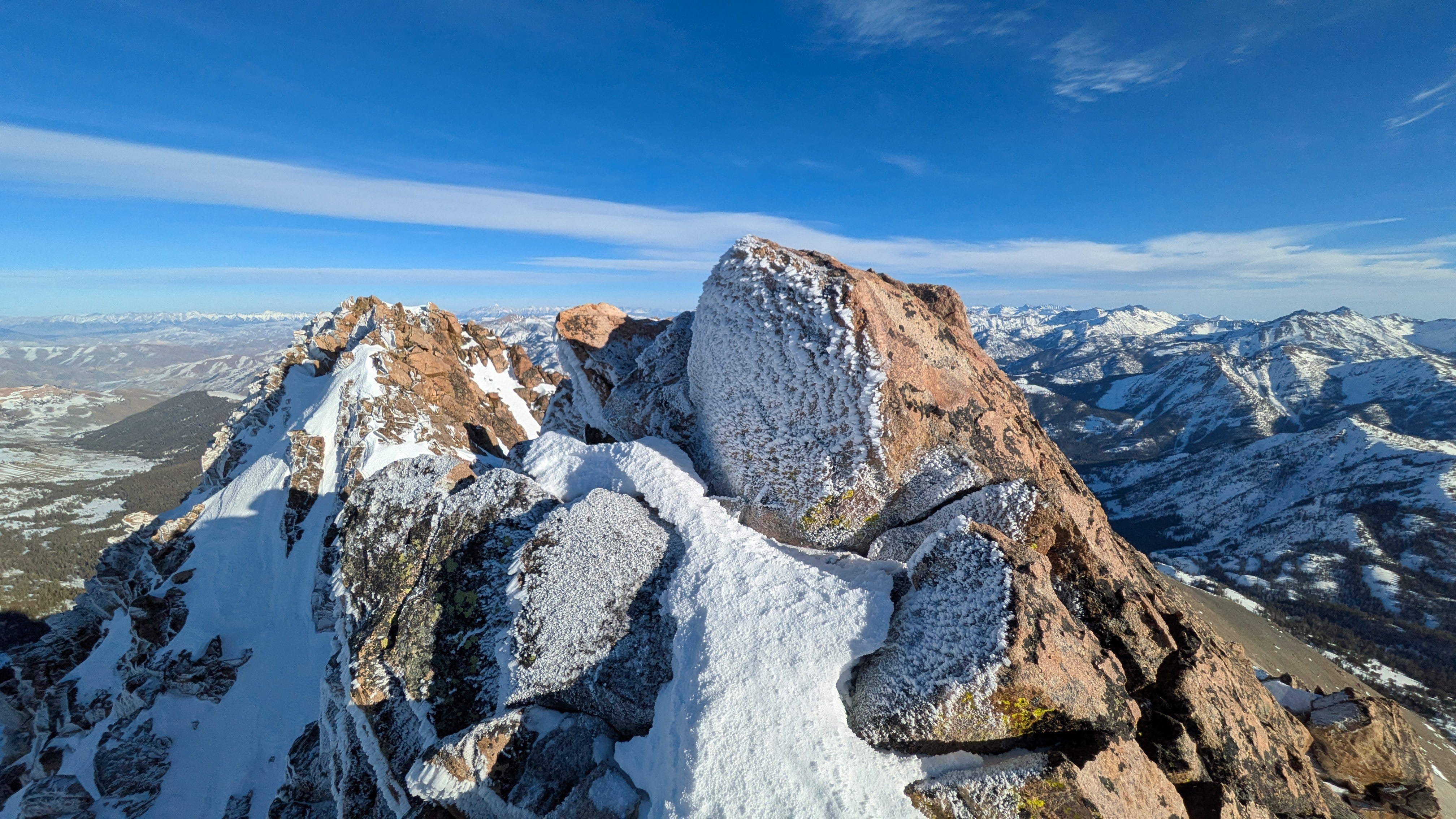
But it doesn’t take more than a short jog down memory lane to be reminded of how ugly avalanche conditions can be. The photo above shows the crown of D3 avalanche that I triggered while skiing a lower-angle ridge adjacent to this bowl. This avalanche occurred on Christmas Eve, just 6 short weeks ago.
As I’m traveling through the mountains, playing on very steep, very consequential slopes, I’m working extra hard to remind myself that it is a privilege to be able to travel this way. Not a privilege I’ve earned, but one granted by the whims of the snow and the weather. And when those whims change, I know that I have to be ready to change too. This includes both adjusting my perception of avalanche hazard as it changes and, importantly, adjusting my desires.
If any of this sounds interesting, go read Roger Atkins’ work.
LOOKING AHEAD
I’ve heard and read the phrase “potential pattern shift” more times in the last few weeks than I care to recall. We’ve had one hypothetical pattern shift after another fade into oblivion as the forever ridge deflected all hopes for powder days. It seems like things are actually going to change this week. I’d hate to curse us, but even a forever ridge eventually breaks down.
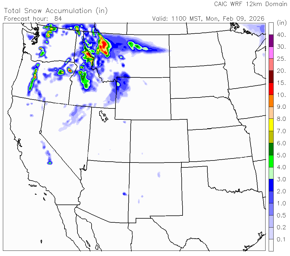
A few shortwave troughs will pass across the Pacific Northwest and continue east this weekend. The first arrives on shore tomorrow, and the second on Sunday. Temperatures are warm with the first feature and the snow line looks like it will rise above 6,000’ as strong westerly winds blow. The second feature is colder, bringing snow a bit further down the mountains. Washington, Oregon, North and Central Idaho, and Northwestern and Western Montana look like they will be the winners through Monday. Here’s a look at the CAIC’s WRF forecasted snow accumulation by Monday morning:
By midweek, the jet stream splits, sending a plume of moisture way up north into Canada and a second plume south into the California coast, across the Sierra, and into Utah and Colorado.
And as we salivate over the potential for skiing fresh snow, we take the time to remind ourselves what it is falling on. The avalanches described above (both loose and slab) do a good job of illustrating what sort of snowpack we have, and what it takes to push it into unstable territory. Without massive amounts of snow in the short term forecast, it may take some time to develop a slab on top of the January Drought Layer. But, if we are paying close attention to surface conditions now and watching the snow as it gradually piles up, we will be ready to make better-informed decisions in our pursuit of soft snow in the mountains.
Spend a bit of time thinking about your mindset as you travel this week. What has it been, and how might it be changing? Then, spend a bit more time thinking about your desires and how you might be reformulating them as the snowy world changes around you.
Thanks as always for your time and your attention. I’ll see you back here next week.
-Ben VandenBos