
HIBERNAL SOLSTICE UPDATE
A West-wide persistent slab begins to be loaded. An avalanche death in Idaho. A heatwave and a wind event. And some thoughts on incremental loading.

Note: A day late for the solstice, but who’s counting? I was having too much fun skiing with my headlamp last night. This is the darkest time of year, a great opportunity to practice making your own light in the world.
WEATHER:
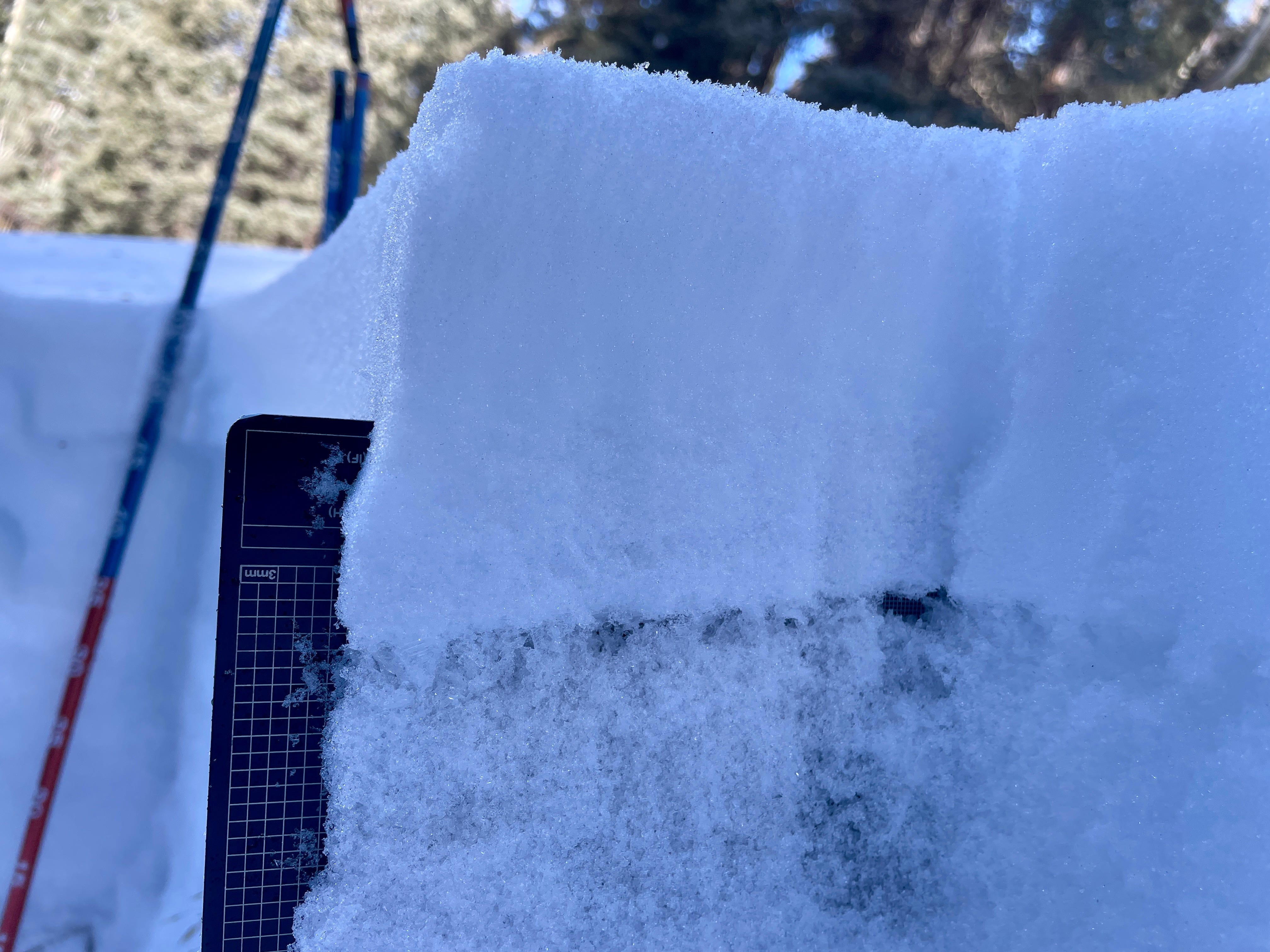
Last week brought a series of storms to the northern portion of the West Coast of the US and coastal BC. Moisture was distributed in a spotty pattern further inland, with favored areas and much drier areas. These storms, beginning December 7th, were the first time that our newest set of major weak layers were loaded. These weak layers are the product of an extended drought at the end of November and the beginning of December. Stacks of facets developed on shady slopes and crusts with and without associated facets formed on slopes facing the sun. Between December 1st and December 7th, atmospheric conditions favorable to surface hoar development were present across much of the Western US. Most of the Avalanche Centers in these areas are finding this surface hoar within their tenure.
A transient ridge of high pressure brought a pause to the snowfall at the beginning of this week. Temperatures warmed dramatically, wet snow problems appeared on the problem list, and many areas saw a snowpack re-sculpting wind event on December 19th. Prior to this wind, recent snowfall had been unconsolidated at the snow surface. This wind provided the slab portion of the avalanche equation and a cycle of wind-driven avalanches was reported in many locations. This combination of wind and sun also had the unfortunate effect of significantly decreasing skiing and riding quality…
But fear not…more snowfall is on the way! A conga line of storms is stacking up in the western Pacific, and again drawing a bead on the Pacific Northwest. These storms are starting out warm and wet, but should trend gradually cooler as time goes on. This pattern should produce another round of weather similar to what we experienced last week. Low elevation rain, heavy mountain snow, and a lack of sunshine. Long range models are showing a return of high pressure to the West in the first days of the coming new year, but its too far out and there is too much model disagreement for much confidence.
How much snow is coming? Big piles of it, eventually! Here is a look at the NBM (National Blend of Models) forecast for the amount of snow falling by Christmas:
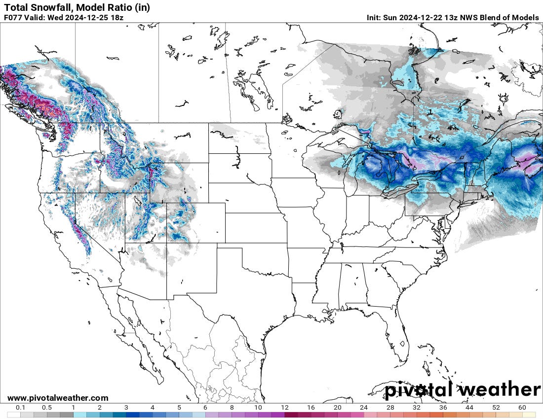
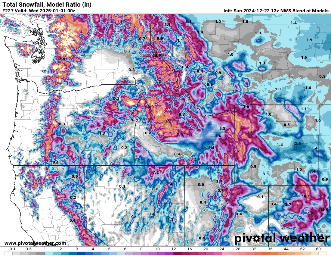
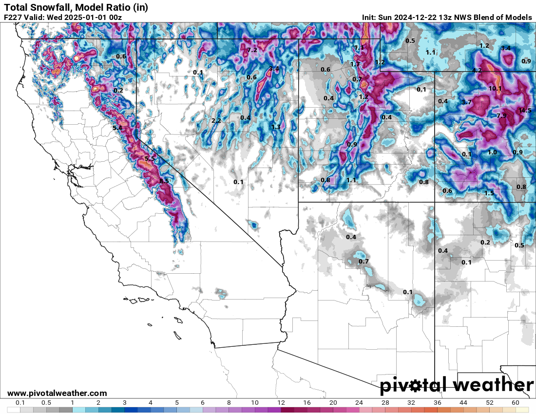
Precipitation is forecast to intensify and continue through the final days of 2024 in these same locations. The two maps below shows the NBM forecast for total snow through 12/31 for the northwestern and southwestern US. The Cascades are slated to pick up 10-15” of water over this period, with favored locations tallying up to 20”. Wow. Go put 20” of water in a bucket and think about how much weight that is for the snowpack.
AVALANCHES:
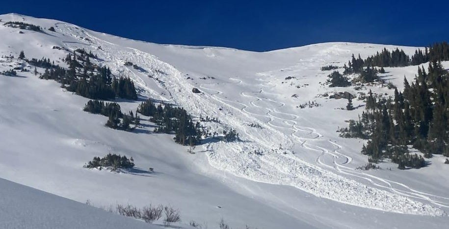
So, we loaded a “good” weak layer that is widespread across much of the Western US. What has the result been? Natural and human-triggered avalanches involving the weak snow buried this month have been reported in many places. Below are a few observations of avalanches by state, in no particular order. Click the date/location to link to the original observation. Most of these avalanches failed on the weak layer formed during the early-December drought. Some stepped down to the older weak layer of facets and depth hoar that is located near the ground in some locations (we call this a “basal” weak layer).
UTAH:
12/17/24 - Days Fork
Skiers remotely triggered a large avalanche that broke 2 feet deep and 100 feet wide, traveling 1,000 feet downslope and breaking trees as it went. As they watched, additional slides released sympathetically. From the ob: “It looked like they were being triggered sequentially, like dominos, about 800 feet north along the ridgeline.” Go read this observation.
COLORADO:
12/16/24 - Near Kelso Peak
Two hikers hikers triggered this small but wide hard slab that failed on weak snow near the ground. Both were caught and one was partially buried.
12/18/24 - Copper Peak
Skiers remotely triggered a large avalanche from the ridgeline above. It broke 1-2 feet deep on an E facing slope at 12,250’.
MONTANA:
12/17/24 - Buck Ridge
Forecasters at the Gallatin National Forest Avalanche Center remotely triggered this slide from an estimated 200 feet away. They experienced no clear signs of instability before triggering the slide. This is an ugly terrain trap, and a great example of how even small slides can carry significant consequences. You do not want to be in the bottom of a gully like this when it fills up with snow.
12/19/24 - Cooke City
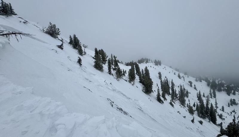
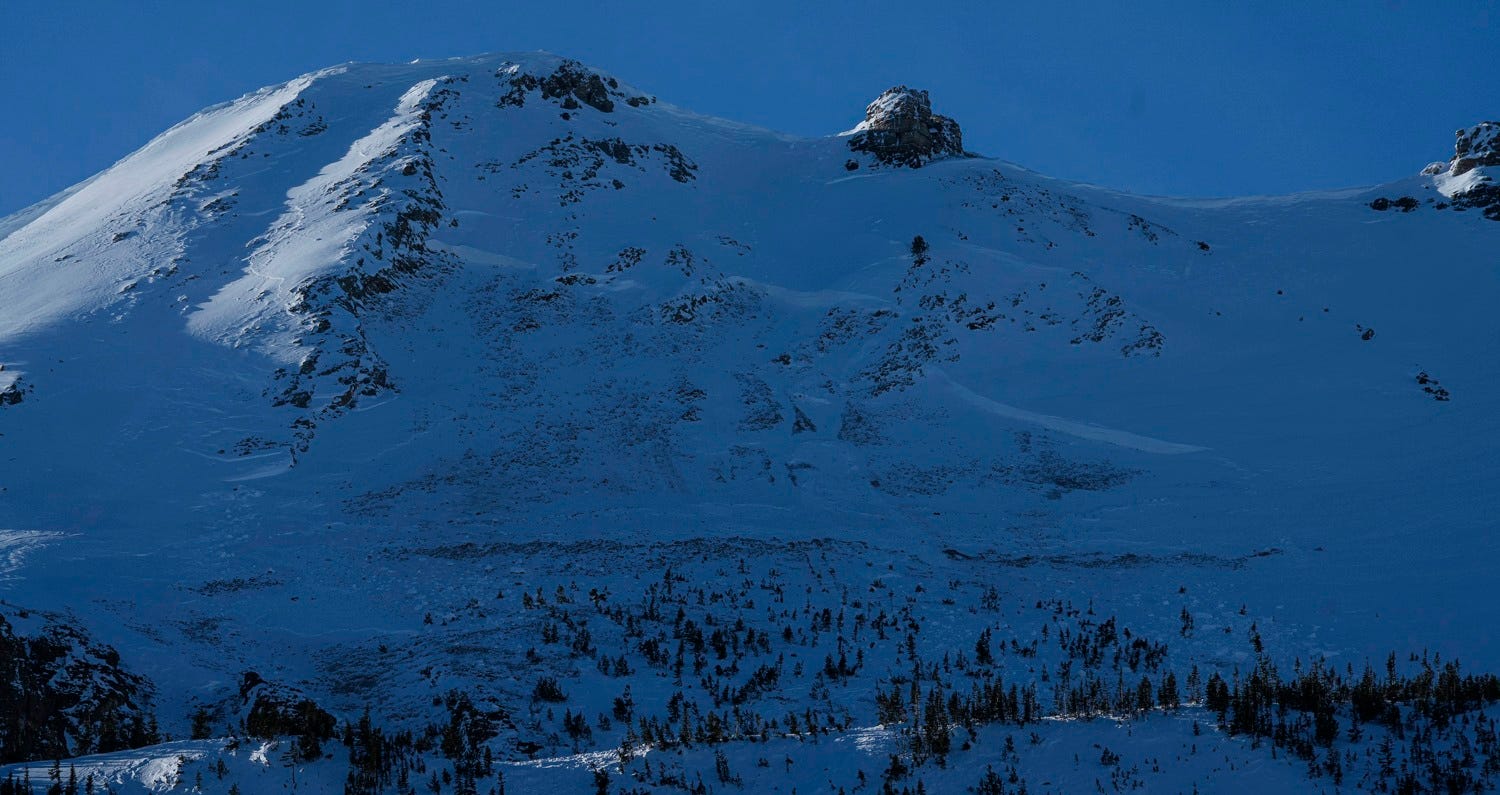
A local observer reported finding a number of large avalanches in the terrain north of Cooke City. Many of these slides failed on facets and surface hoar buried beginning December 7th. The very large avalanche pictured below appears to have failed on weak snow near the ground. That is a big crown. Follow the link to see other photos of recent activity in the Cooke City area.
12/20/24 - Elk Mountain
A snowboarder triggered this sizable avalanche while riding the slope. They were not caught or carried by the avalanche.
IDAHO:
12/15/24 - Lookout Peak, near Cascade
This was the first avalanche fatality in the US this season. A snowbiker was caught, carried, fully buried, and killed by a wide avalanche in a relatively small piece of terrain. This occurred just south of one of the forecast zones of the Payette Avalanche Center. Preliminary details are available by clicking the link above.
Fatal avalanche accidents are tragic events that affect entire communities. My heart and deep, sincere condolences go out to all involved and affected. These are not hollow words. Be respectful and humble when reading about and discussing these events.
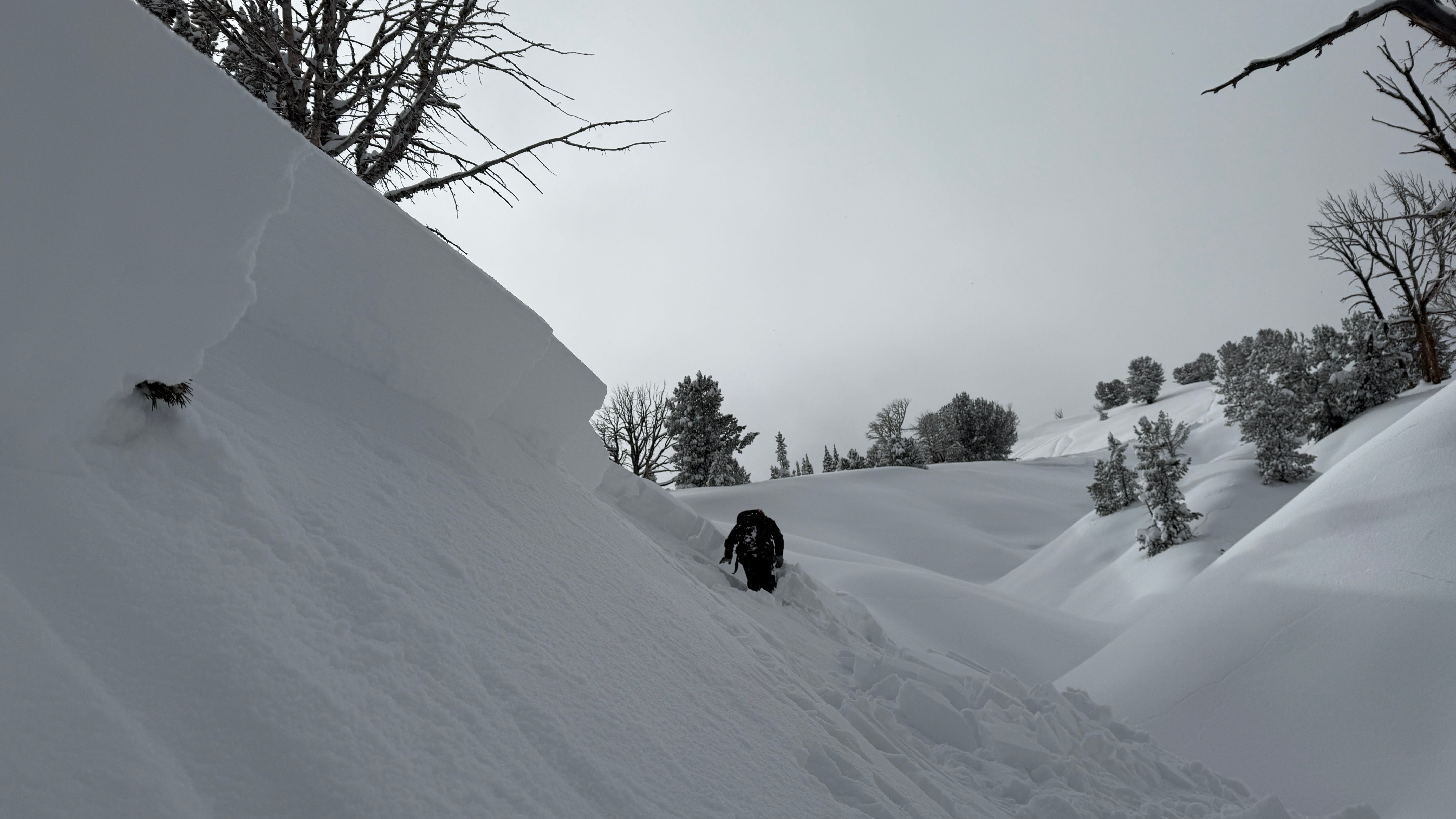
BRIEF FACET-LANCHE DIVERSION
In Colorado, snowfall has been meager in the weeks since Thanksgiving. Here, wind has been the major driver of avalanche hazard, particularly in the northern portion of the state. The upper snowpack is undergoing heavy faceting and loose dry facet avalanches have become easy to trigger in places. This is a sure sign of a bad weak layer brewing. It is at the surface now, but I’m sure we will be hearing more about it when it becomes buried and loaded. Check out this video from the good people at the Crested Butte Avalanche Center below of a triggered facet-lanche:
INCREMETAL LOADING of PERSISTENT WEAK LAYERS
The list of avalanches above is far from a complete accounting. However, a few themes should stick out to you. Avalanches are being triggered remotely and sympathetic slides are releasing long distances away. In some instances, the involved parties are reporting few or no signs of obvious instability prior to triggering slides. Perhaps most importantly, these avalanches are occurring after relatively small loading events.
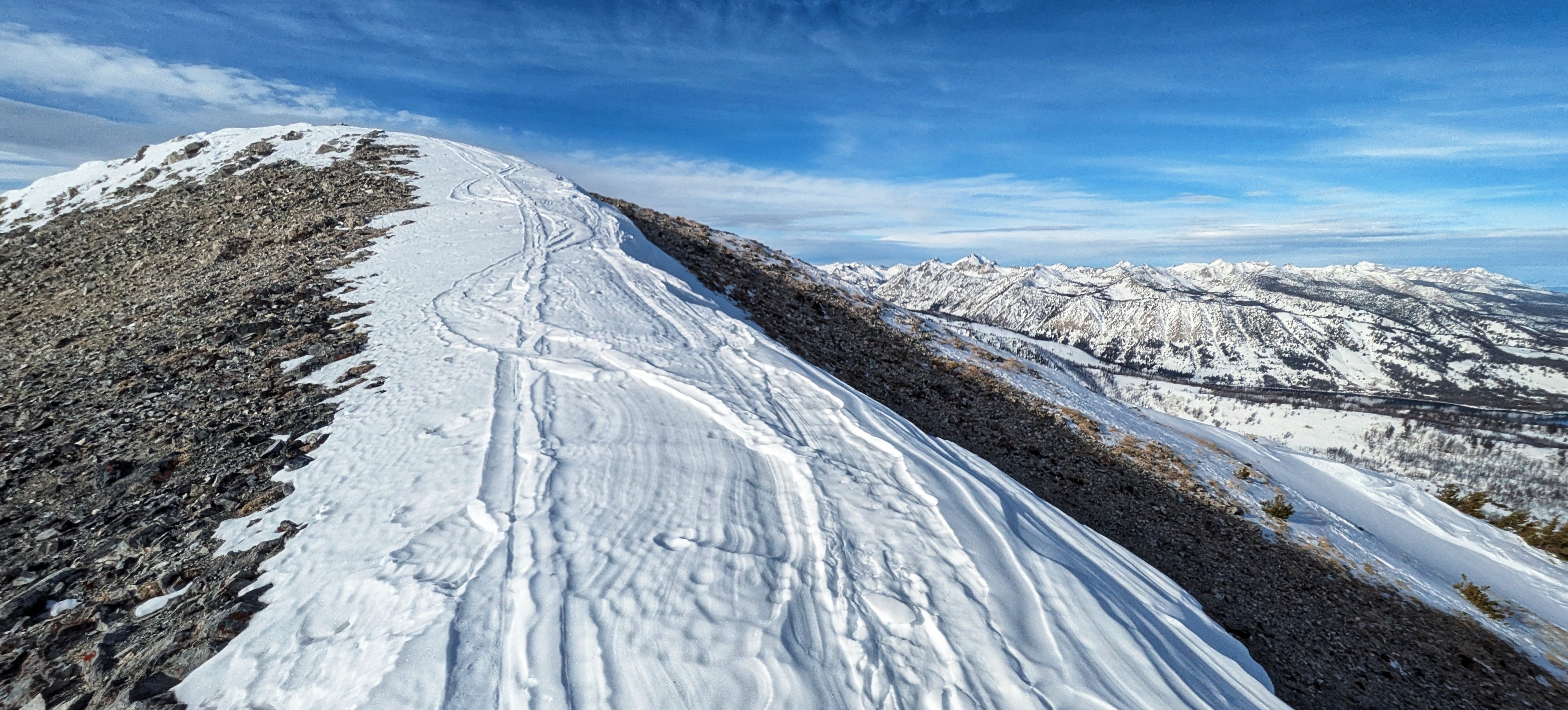
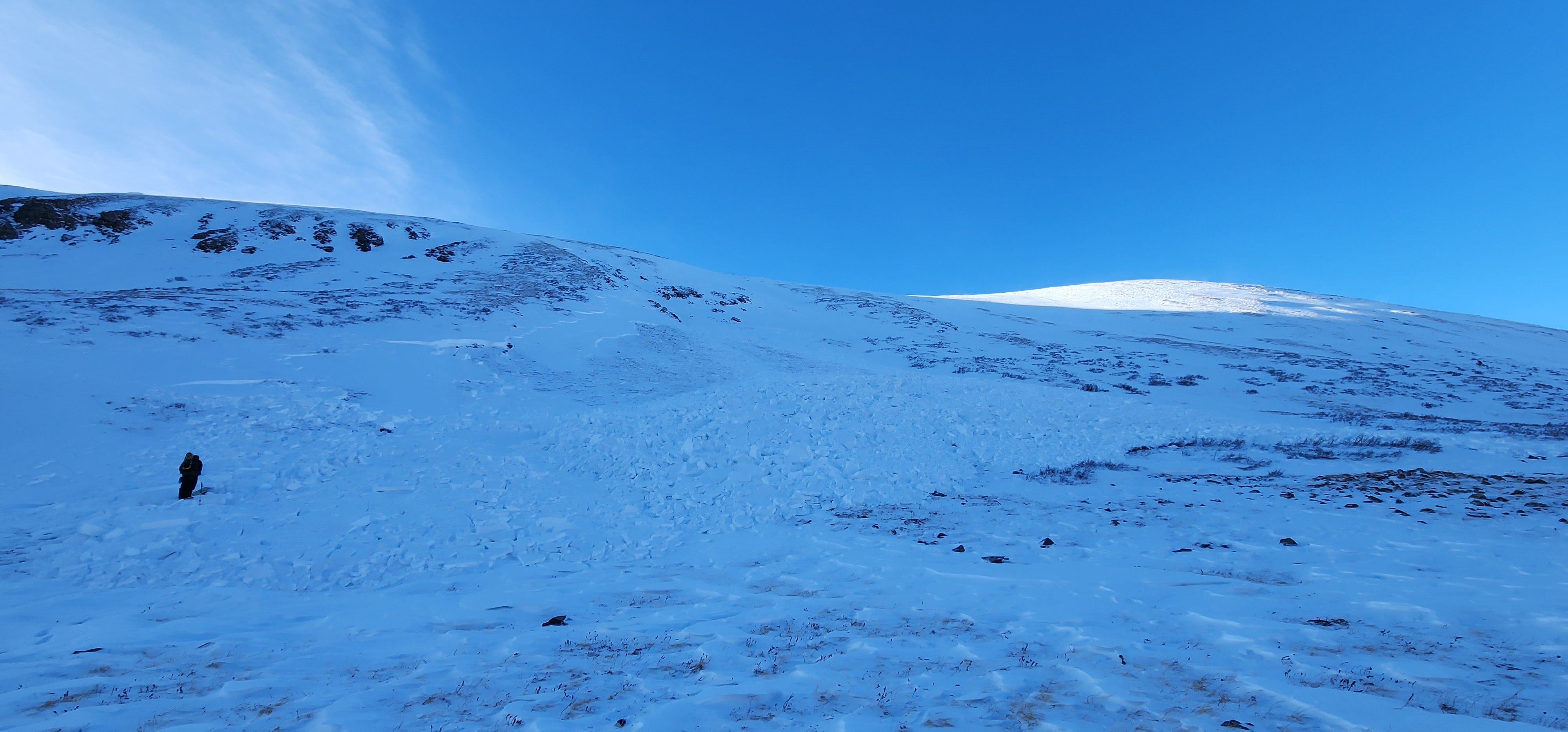
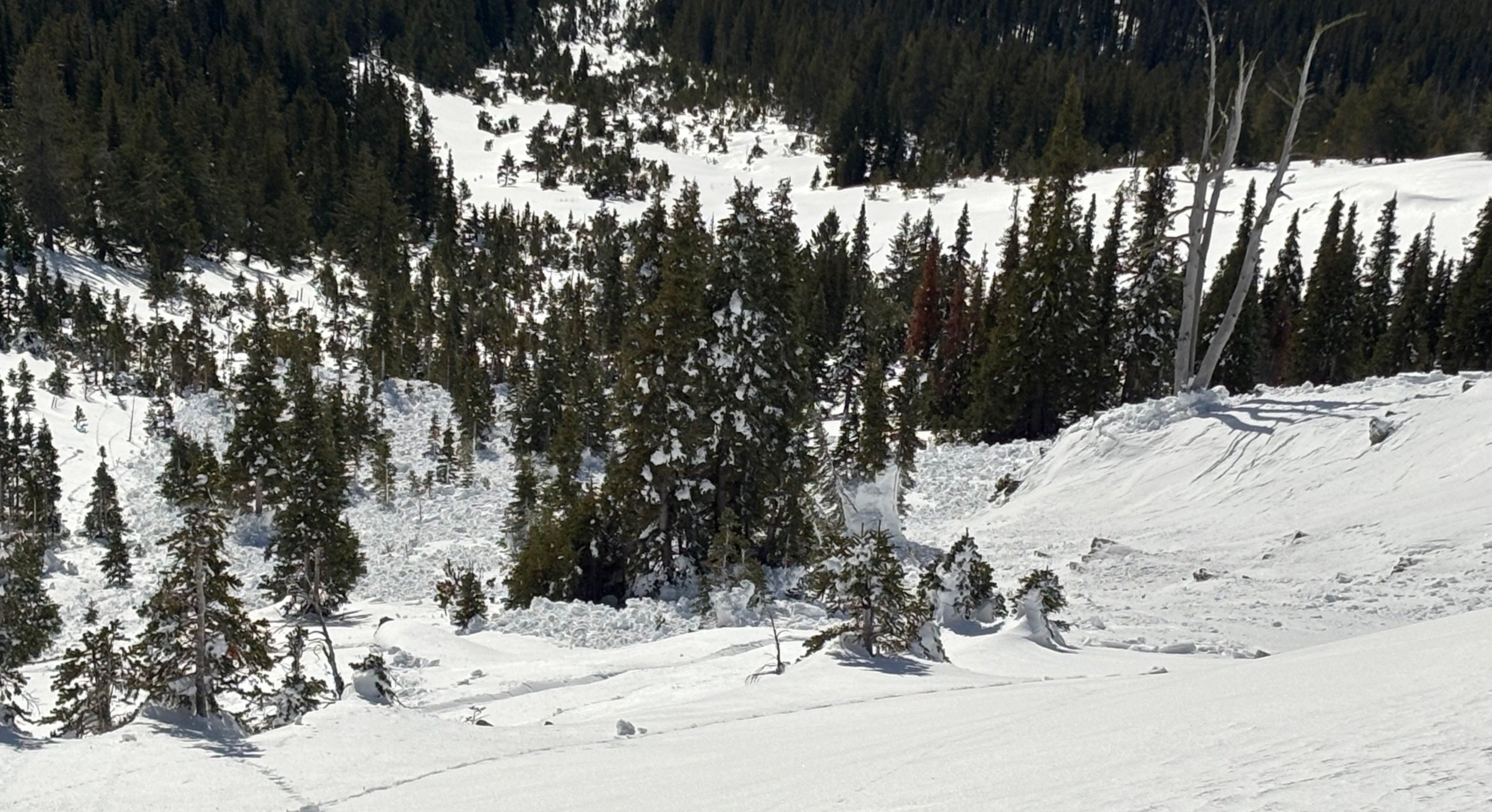
The 12/7 through 12/13 weak layers are widespread, but most areas inland of the coast have not received enough snow/water to create large, thick, well-connected slabs…yet (see photo above). Because of this, avalanche activity has generally been “pockety”. Many relatively small slides have failed on the December drought layer, but reports of widespread persistent slab activity involving entire large starting zones have been few. This pattern is likely to change as we add more meat to the overlying slab and add more stress to the weak snow below.
We are a long way from being out of the woods with these weak layers. In fact, we are just starting our relationship with them. The layers are buried and preserved in the snowpack, and they won’t go away quickly. Loading over the next 10 days will build and stiffen the slab overlying these weak layers. Avalanches will become easier to trigger and large to very large natural persistent slab avalanches will become likely in areas receiving the most snow. Looking at the predicted snow distribution maps above indicates that portions of Idaho, Montana, Wyoming, Colorado, Utah, California, Oregon, and Washington are very likely to see periods of elevated danger and increasingly large avalanches as the snow piles up.
We are headed for Christmas with a bad combination of factors: widespread persistent weak layers, big storms, lots of powder-hungry skiers and riders with free time, and a large population of people getting out for their first or first few days of the year in the backcountry. This list makes the hair on the back of my neck stand up. Travel through the mountains with a sense of humility and with respect for the dangerous game we are playing out there. Keep your eyes wide, recognize the limits of your knowledge and your experience, and be ready to learn a thing or two along the way.
-Ben VandenBos
Note: Do you want to read more about incremental and cumulative loading of persistent weak layers? If you are a member of the American Avalanche Association I’ve got great news for you: there is a roundtable discussion from a group of American Avalanche Forecasters (including yours truly) covering this topic in the latest edition of The Avalanche Review, which should be arriving in your mailbox any day. If you aren’t a member you probably should be! Go sign up, if you are interested in avalanches you will not regret it.