
WINDY -> HOT -> WINDY -> COLD
A mid-January update: loading rates slow, PWLs linger, more human triggered avalanches, and the construction of the next weak layer.

Note: I intended to publish this yesterday, January 16th, but life gets in the way sometimes. A day late, a dollar short…happy belated birthday, Mom! Thanks for giving me a love for being outside and playing in the dirt.
In our last update, published on January 8th, we approached the end of an extended loading event that began in mid-December. Storm after storm loaded a widespread weak layer (I’ve been calling this the late-fall drought layer, or LFDL) and produced thousands of large avalanches across the West.
Slides broke widely and piled debris deeply. Numerous close calls and minor accidents occurred during this period, and 5 backcountry travelers were killed in 5 separate accidents during an 11-day span (link to US accident database here). More details about the snowpack and these accidents are available in the previous post.
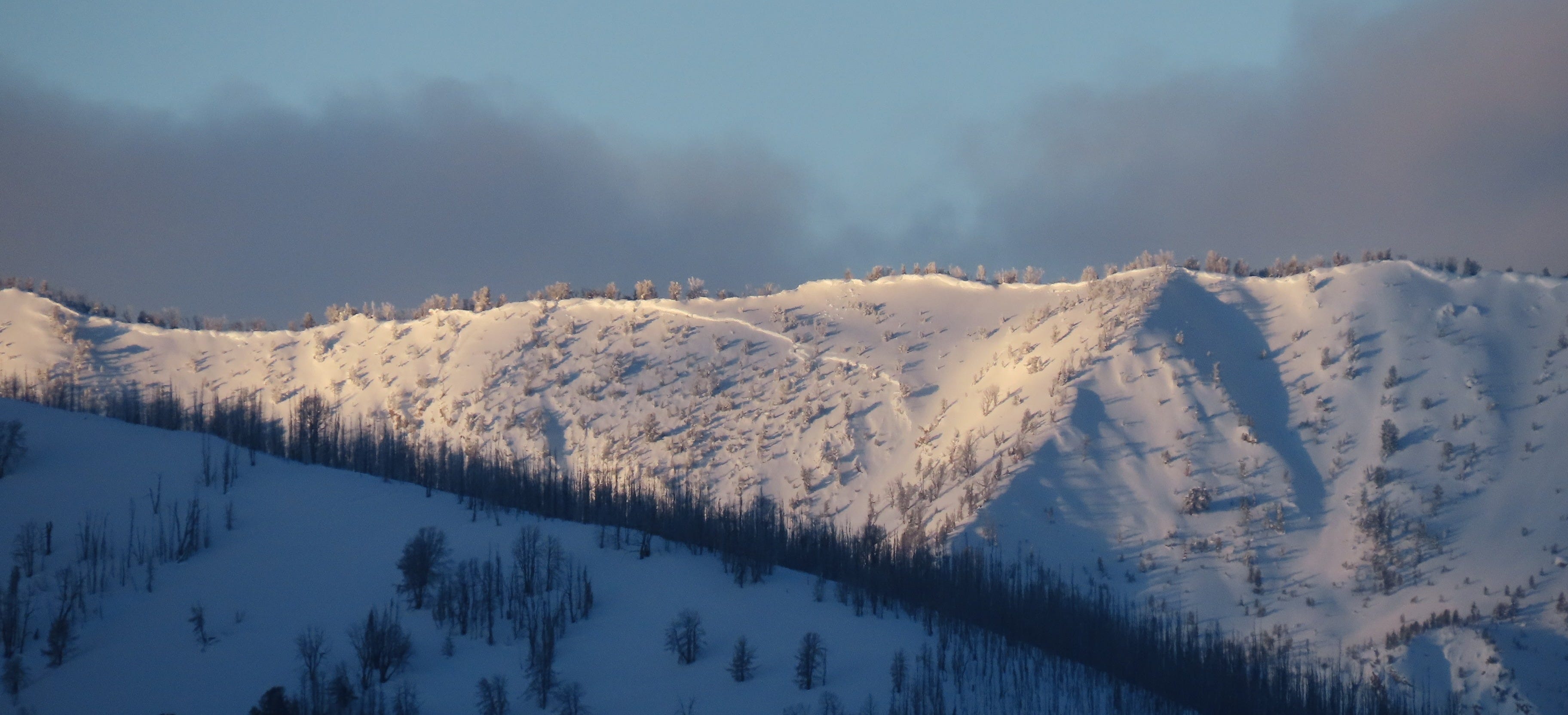
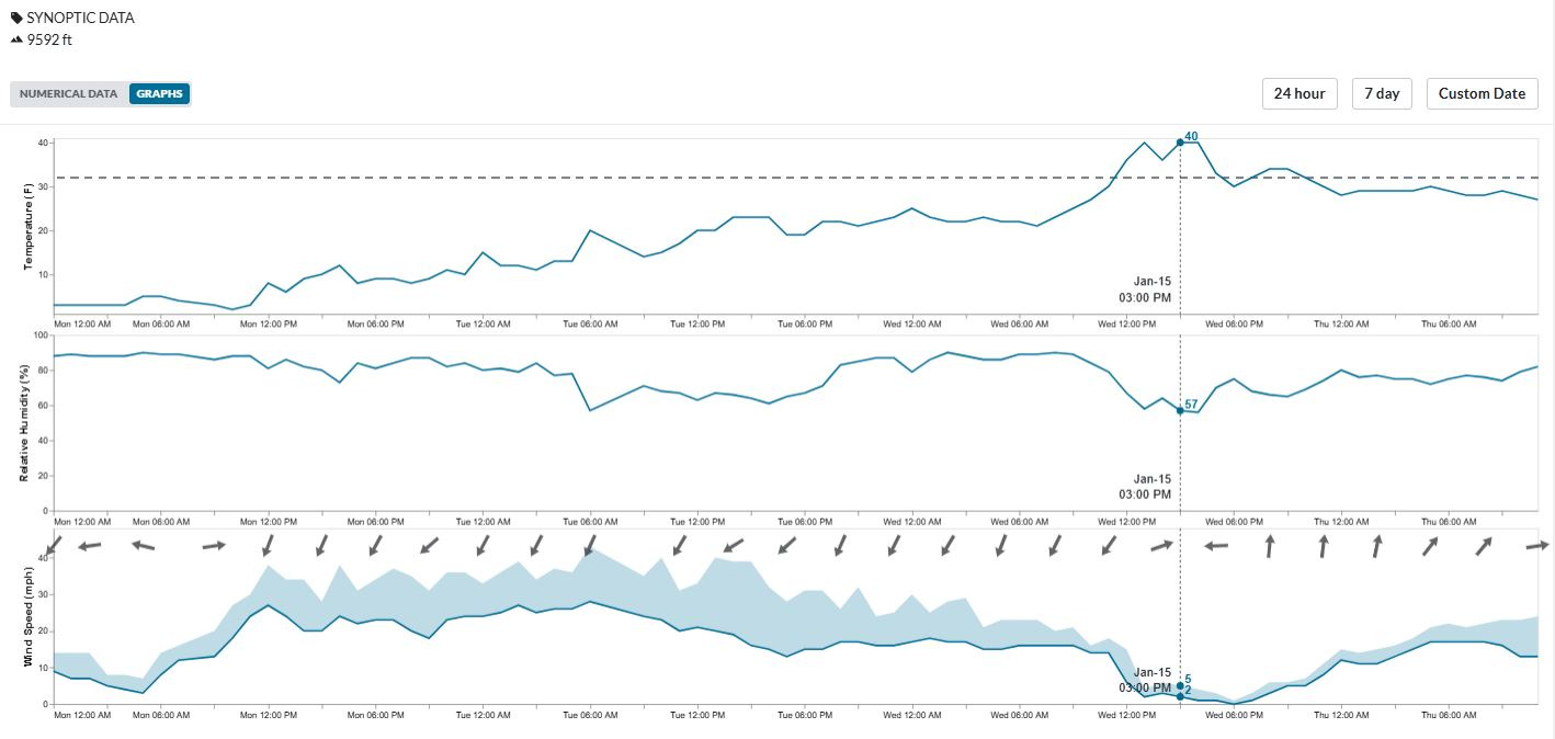
Following a break in precipitation, the winds started honking. Beginning around January 7th, most areas saw a dramatic, multi-day wind event. Cold, strong winds blew from the NW-N-NE, wreaking havoc on the snow quality in many places. These winds also transported significant amounts of snow. Many slopes were in an erosional wind regime, with winds peeling apart the snowpack, grain by grain, and sending it airborne.
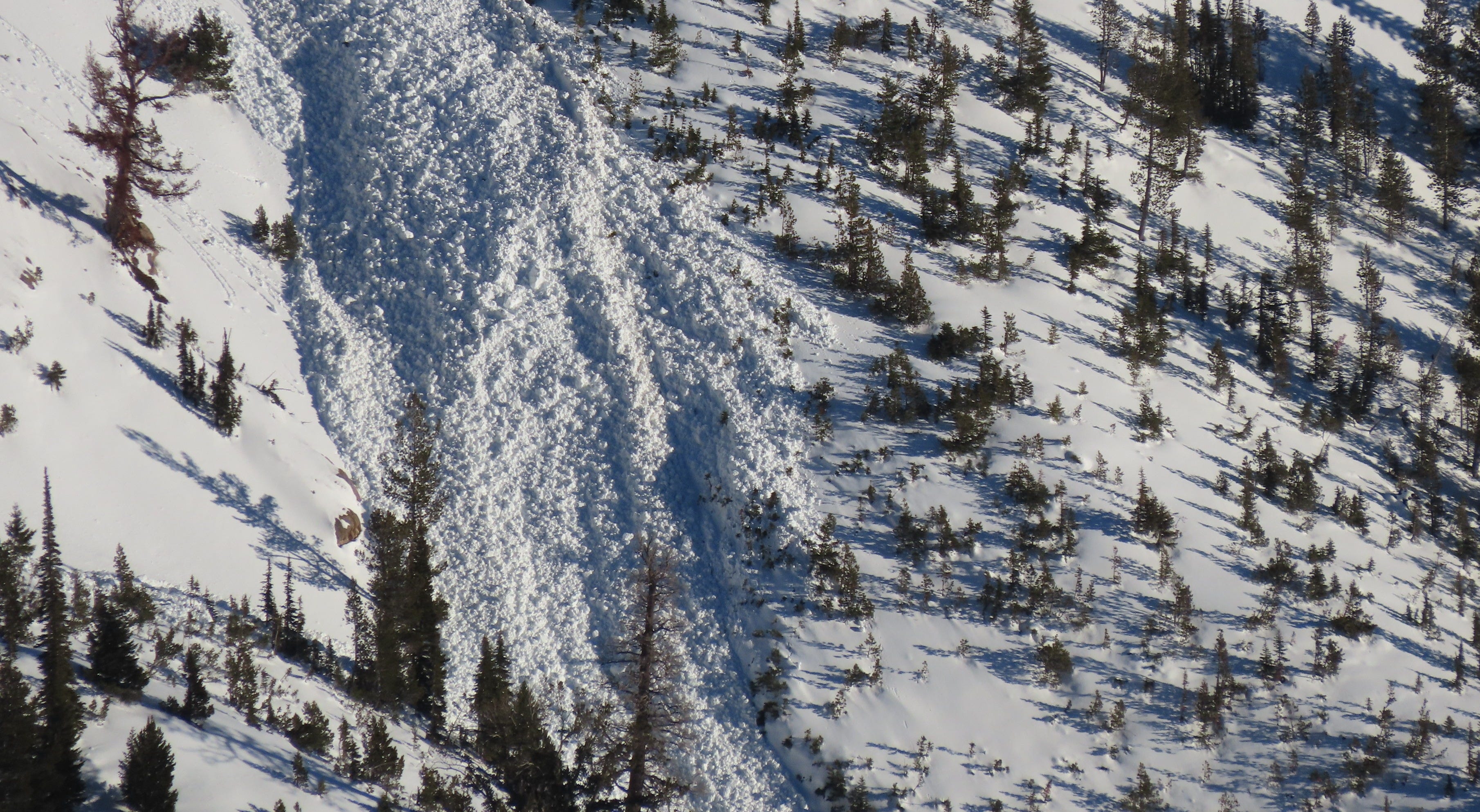
On slopes where the wind was depositing snow, stiff hard slabs were built. This additional load and slab stiffening were enough to push some of these loaded slopes to their breaking points:
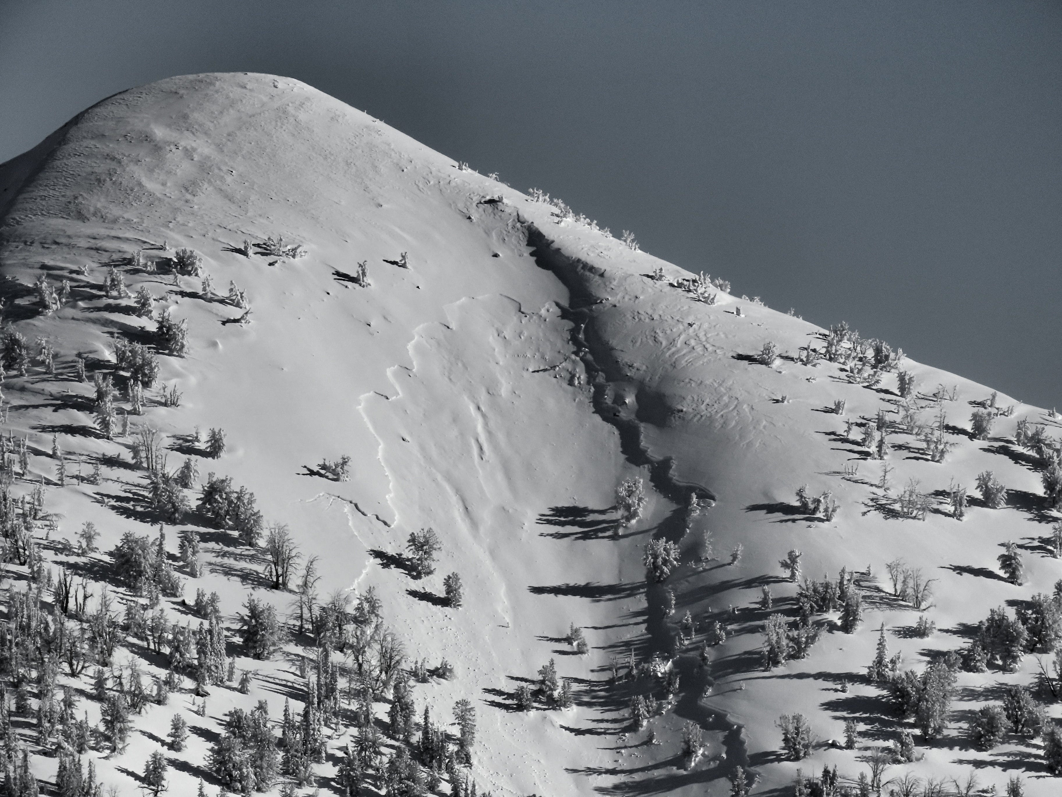
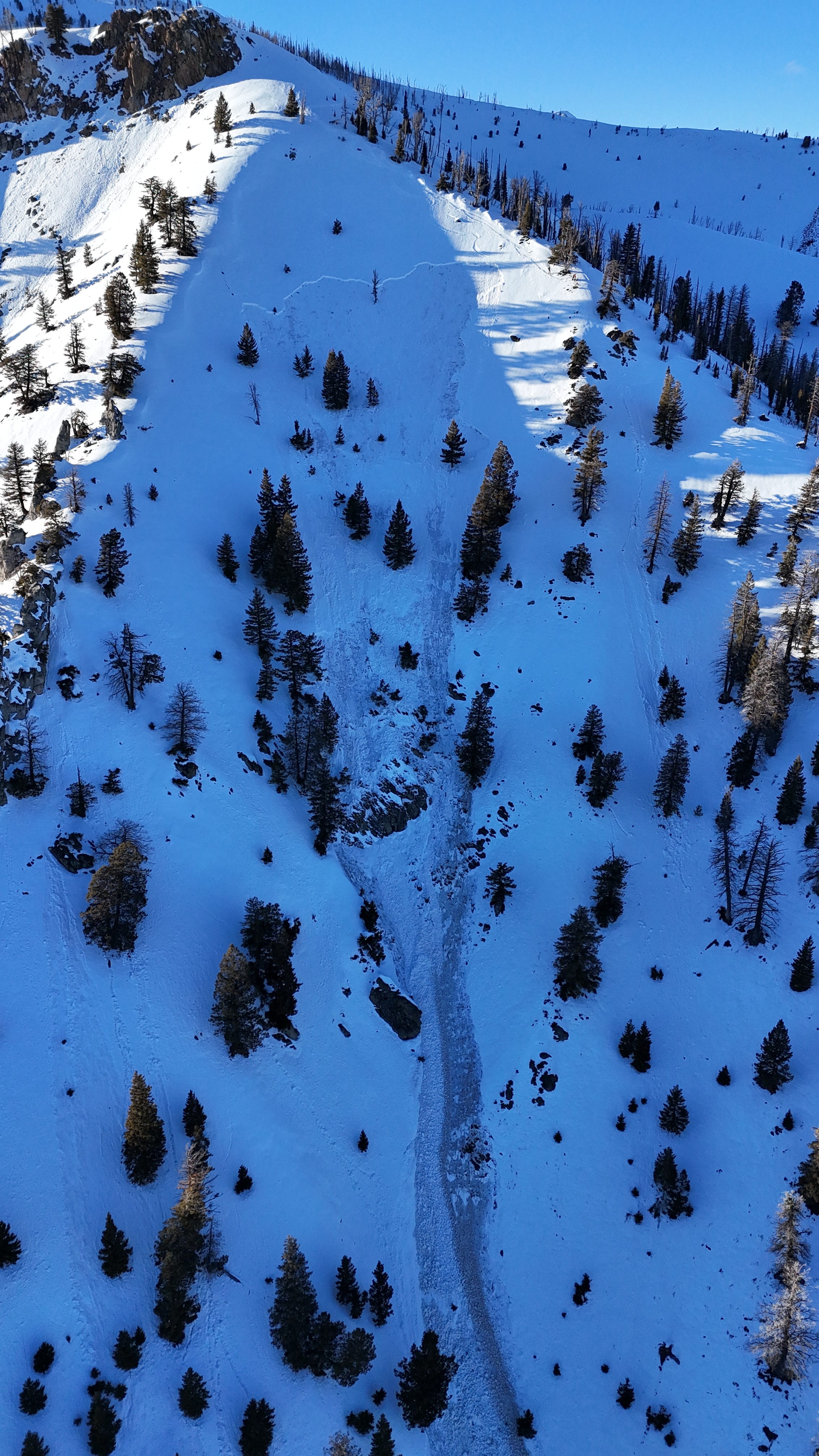
In places, the wind eased right as temperatures began to spike (see weather chart below). Beginning on January 14th, wet snow issues popped up in numerous locations. Here in central Idaho we had some small activity on the 14th that foreshadowed a more widespread cycle on the 15th and some continued activity on the 16th. A similar wet snow shedding was observed across the Intermountain West. Avalanches were primarily of the wet loose variety, but at least two wet slab avalanches were observed in steep, rocky terrain here (crown of one pictured below). You can read a little more about wet slabs further down in this article.
HUMAN TRIGGERED AVALANCHES
We are a week out from the last major snowfall for most of the Western US. Generally speaking, the likelihood of triggering slides has decreased and the danger has dropped along with it. As of today, January 17th, the Gore Range, Tenmile Range, and Front Range around Summit County is the only forecast zone in the Continental US still at CONSIDERABLE danger. In their Forecast Discussion for today, CAIC Forecasters state, “Another large remotely triggered avalanche reported yesterday evening prompted us to keep the avalanche danger at CONSIDERABLE…” You can find more information on this slide below.
Aside from the zone of CONSIDERABLE danger described above, danger has dropped to either MODERATE or LOW everywhere else:
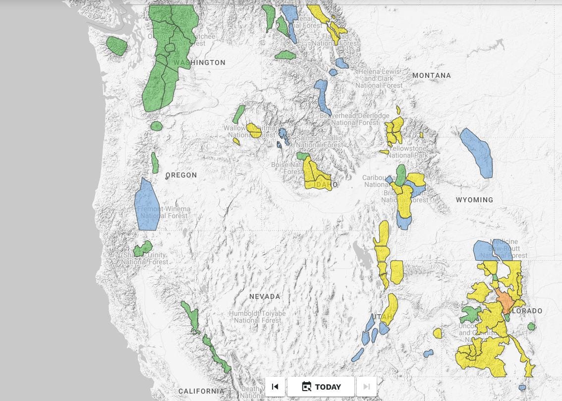
Of course, the colors only tell a portion of the story. Many Forecast Centers are still describing a persistent slab problem, generally revolving around the late-fall drought layer (LFDL). In the northern US along the Canadian border, this layer has been deeply buried and the associated persistent slab problem has been removed from problem lists. Here, Forecasters are describing surficial snowpack issues (wind slabs, wet loose) and challenging travel conditions thanks to the widespread rain event from early January and a lack of subsequent snowfall.
However, if you head south just a bit into southwest Montana, south and central Idaho, and most of Utah, Colorado, and Wyoming, the LFDL is alive and well. Large, human triggered avalanches failing on this layer have been reported in recent days in both Utah and Colorado. I’m linking to a few pertinent observations and avalanches from the last few days below:
UTAH:
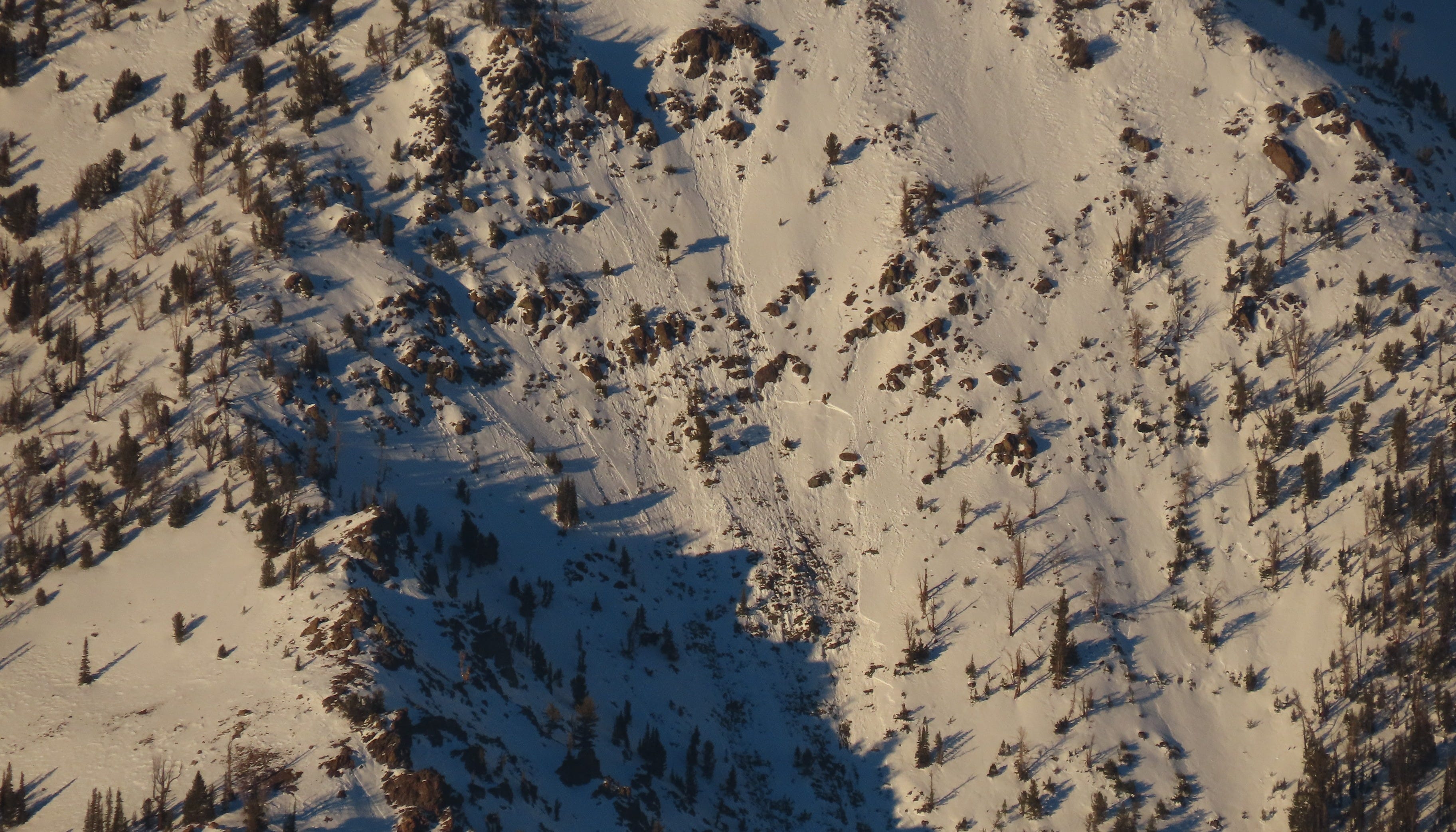
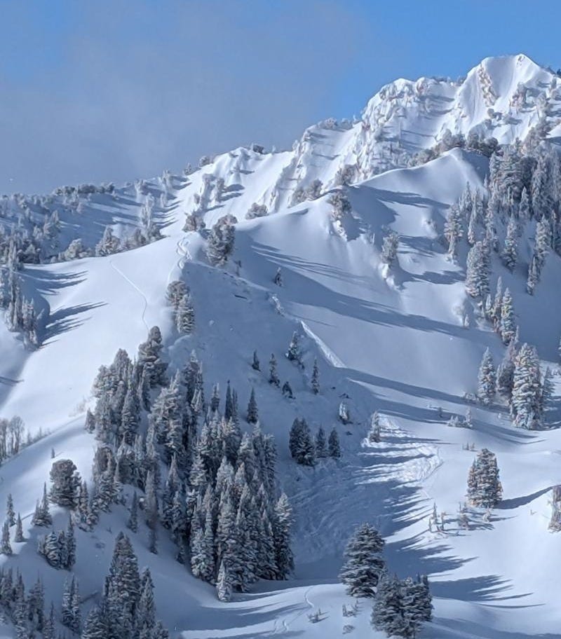
-January 12th, 2025 - Butler Basin - Skier caught, carried, and partially buried (photo below). On January 14th, UAC Forecasters with decades of experience (each!) visited the site of this avalanche. Read about what they found here.
-January 16th, 2025 - Pioneer Ridge - Skier caught and carried. This is a good, introspective observation. Go read it.
COLORADO:
-January 13th, 2025 - Middle Fork Swan - Large, deep avalanche remotely triggered by skiers.
-January 15th, 2025 - Northern San Juan - Large avalanches remotely and sympathetically triggered from hundreds of feet away.
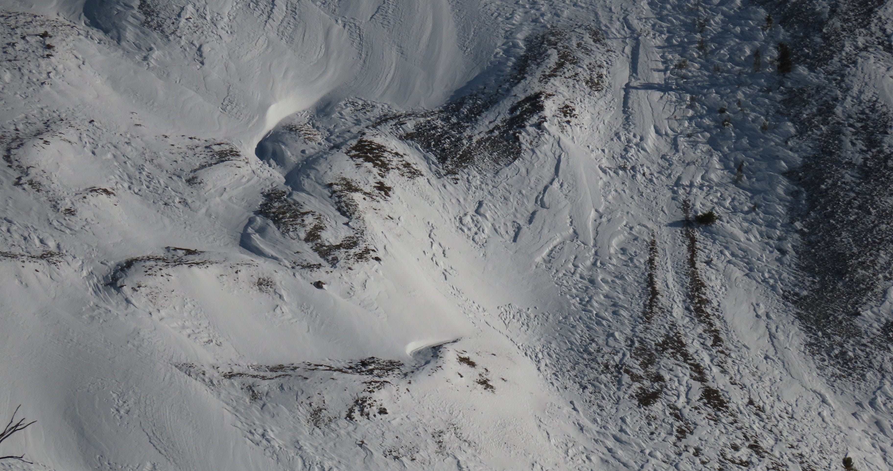
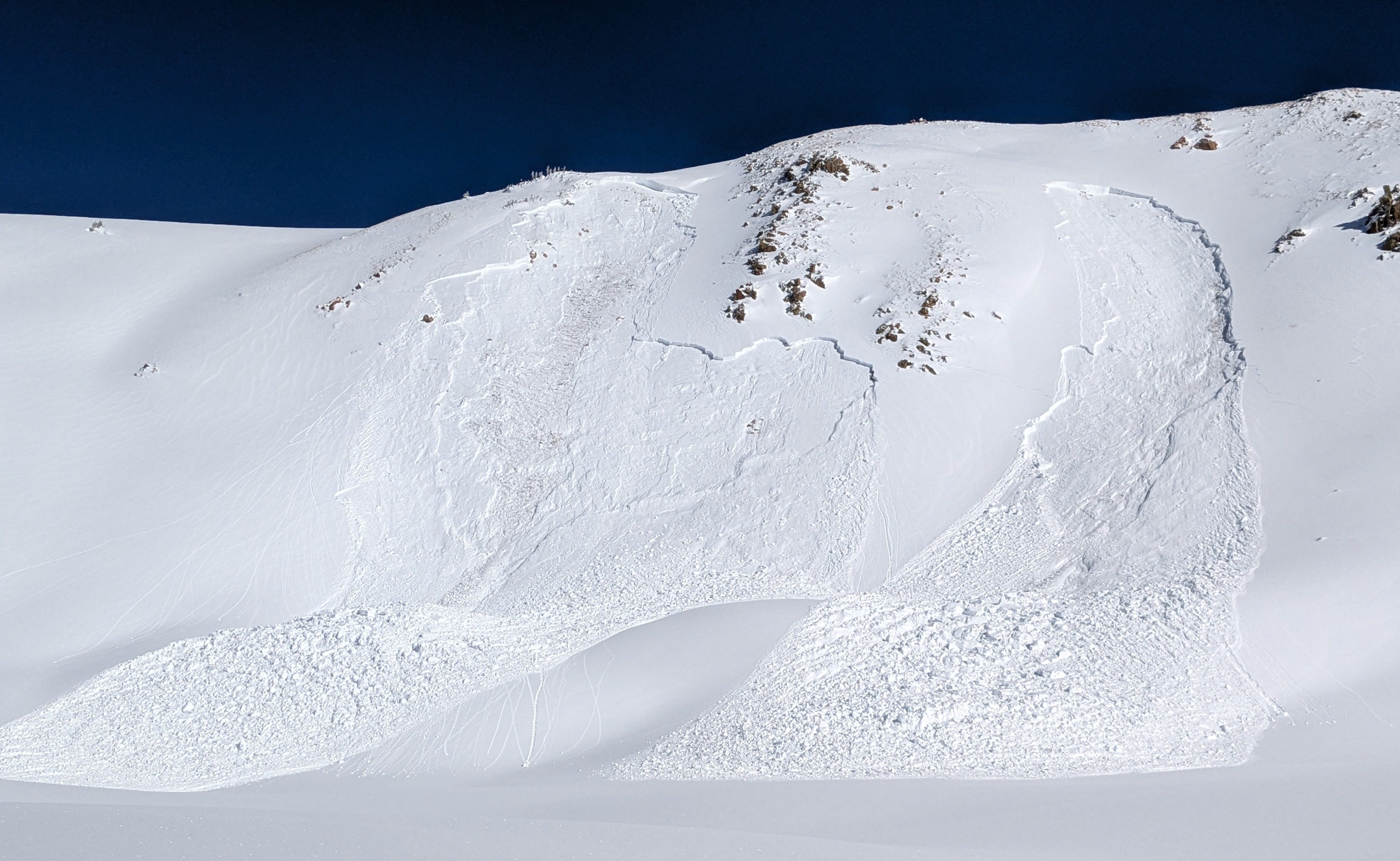
-January 15th, 2025 - Uneva Peak - Large avalanches remotely and sympathetically triggered from hundreds of feet away (photo below).
These avalanches and observations do a great job of illustrating what moving through the mountains with a lingering persistent slab problem looks like. We don’t outthink problems like this, we either avoid the terrain where they exist or we roll the dice and accept the results. Are we getting it, or are we getting away with it?
A BRIEF WET SLAB DIVERSION
We are almost a year out from an impressive late-January wet slab cycle that occurred in Idaho. On the afternoon of January 29th, 2024, a concentration of wet slab avalanches released naturally under the influence of the sun and warm air temperatures. Avalanches failed on a weak layer of snow that developed during a December drought (a crust with facets on top). That day, I went out on what I like to think of as “Wet Snow Patrol”, and directly watched and listened to some of these avalanches as they happened. This was a glimpse into a rare phenomena, and it was wild. One D2 released only about 600 feet away from my (safe) observation location. Wet Snow Patrol is generally hot, bright, gloppy, and occasionally quite unpleasant…it is not all glamour and cheering fans out there.
Wet slabs are poorly understood. The Avalanche.org encyclopedia defines a wet slab as a “release of a cohesive layer of snow (a slab) caused by meltwater weakening the bond between the slab and an underlying weak layer”. Complicating this understanding is the fact that the properties of the overlying slab are changing at the same time as the weak layer is being wetted and losing strength. Hmmm, that sounds pretty complex.
Regardless of the mechanism, we know that wet slab avalanches require a slab, a weak layer, and some amount of water within the slab + weak layer system. The natural portion of this cycle appeared to start and end on January 29th, but temperatures remained warm and overnight freezes were weak for the next few days. On January 31st, during the heat of the afternoon, I intentionally, remotely triggered a large wet slab avalanche while on a volunteer day to help another Forecaster. What a week that was.
FORECASTER APPRECIATION CORNER
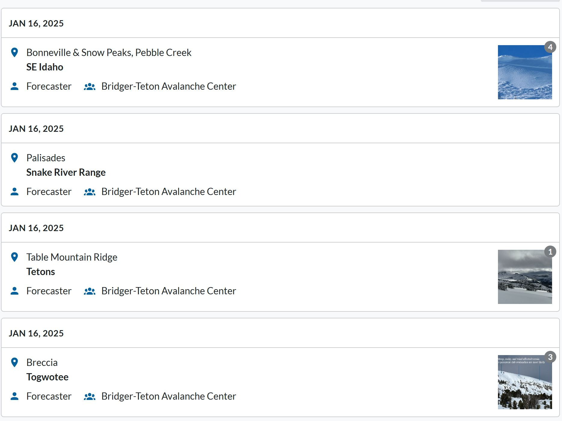
Avalanche Forecasters put in a lot of leg work to provide you with accurate, field-verified forecasts. Last week we looked at some great obs from the women and men at NWAC. This morning, while reading observations I was impressed to see that the good people at the Bridger-Teton Avalance Center had posted 4 separate Forecaster Observations on a single day! Good stuff. This is how you produce high-quality forecasts and generate public trust and confidence in the forecasts you are writing.
LOOKING FORWARD
If you hate precipitation, the long-range forecast is looking pretty good! If you like to see snowflakes falling, the Western US will not be the best spot to be for the next little bit. As I write this, a mass of dry, Arctic air is pushing its way down from the Candian Shield. Expect to see temperatures plummeting this weekend and some light, gradually accumulating snowfall in favored locations (roughly Central Montana down through Central Colorado).
Look for a shift in the weather beginning next weekend. The blocking ridge of high pressure will break down as the jet stream attempts to deliver moisture further inland. As of this writing, it appears that the jet will struggle to fall into a stable pattern and snowfall amounts will be on the light side, but precipitation rates could be high. Don’t expect to see a repeat of the major December and early January storms just yet. However, a few areas that have had pretty tough snow years so far look like they will be picking up some moisture (Arizona and southeastern Utah).
With major snowfall drawing to a close this week, we switched from a loading regime to one of weak layer building. We are in the midst of a drought that will result in the formation of our next significant weak layer. In many places, particularly those with thin snowpacks, this weak snow is already developing (read this great observation from Zach Guy at the Crested Butte Avalanche Center).
A more productive weather pattern is beginning to show its hand for the end of the month, but we are much too far out to have any confidence yet. In the meantime, enjoy the sunshine and the lengthening days. It is a good time to be watching weak layers form, mapping their distribution, and seeing how they change over time.
-Ben VandenBos